
Archivo: India disputed areas map

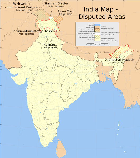
Descripción: Map showing disputed areas of India. See also File:India Pakistan China Disputed Areas Map.png.
Título: India map disputed areas
Créditos: Trabajo propio International Borders: University of Texas map library - India Political map 2001 Disputed Borders: University of Texas map library - China-India Borders - Eastern Sector 1988 & Western Sector 1988 - Kashmir Region 2004 - Kashmir Maps. State and District boundaries: Census of India - 2001 Census State Maps - Survey of India Maps. Other sources: US Army Map Service, Survey of India Map Explorer, Columbia University Map specific sources: .
Autor(a): w:user:Planemad
Permiso: The frontiers depicted on the Indian maps in Wikipedia are from a neutral point of view and may differ from official government maps of India, Pakistan and China. Please consult local laws governing publication of maps before usage.
Términos de Uso: Creative Commons Attribution-Share Alike 3.0
Licencia: CC BY-SA 3.0
Enlace de Licencia: https://creativecommons.org/licenses/by-sa/3.0
¿Se exige la atribución?: Sí
Usos del archivo
La siguiente página enlaza a este archivo:
