
Archivo: Illyrians in the 7th-4th centuries BC
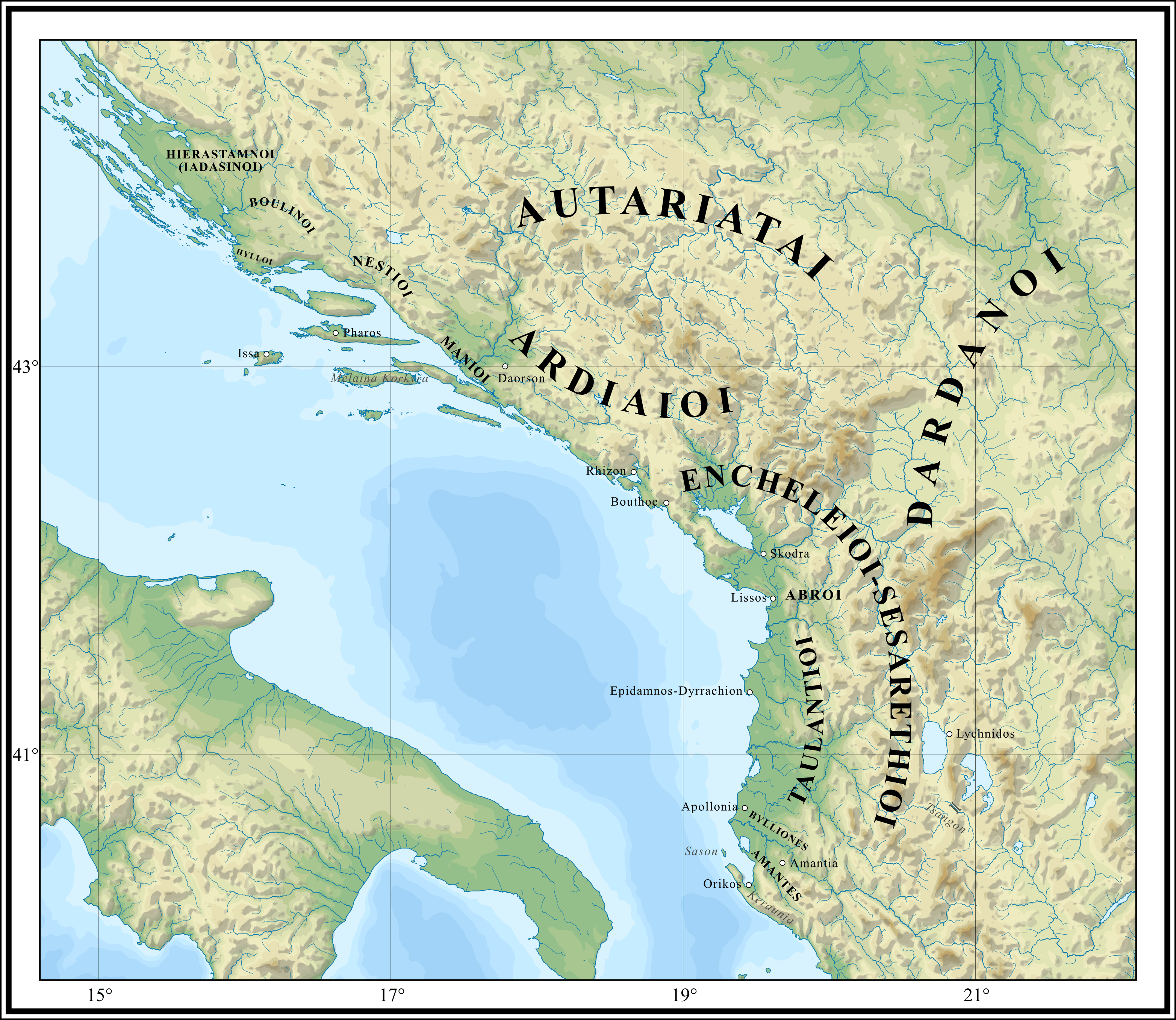
Descripción: Map depicting the Illyrians in the 7th–4th centuries BC (tribal distribution and settlement locations).
Título: Illyrians in the 7th-4th centuries BC
Créditos: Trabajo propio, based on following sources: Eichner, Heiner (2004) "Illyrisch – die unbekannte Sprache" in Eichner, Heiner , ed. (alemán) Die Illyrer. Archäologische Funde des 1. Vorchristlichen Jahrtausends aus Albanien, Museum für Urgeschichte Asparn an der Zaya, pp. 92–117 ISBN: 3-85460-215-4. Matijašić, Ivan (2011). ""Shrieking like Illyrians": Historical geography and the Greek perspective of the Illyrian world in the 5th century BC". Arheološki Vestnik 62: 289–316. Research Centre of the Slovenian Academy of Sciences and Arts. Šašel Kos, Marjeta (2013). "The 'great lake' and the Autariatai in Pseudo-Skylax". Mélanges de l'École française de Rome: Antiquité 125 (1): 247–257. DOI:10.4000/mefra.1376. Shipley, Graham (2020) Pseudo-Skylax's Periplous: The Circumnavigation of the Inhabited World : Text, Translation and Commentary, Liverpool University Press Series (2.o ed.), Oxford University Press ISBN: 9781789620917. Topography taken from the vectorial map of the Balkans, made by Ikonast. File:Geographic_map_of_Balkan_Peninsula.svg
Autor(a): Ahmet Q.
Términos de Uso: Creative Commons Attribution-Share Alike 4.0
Licencia: CC BY-SA 4.0
Enlace de Licencia: https://creativecommons.org/licenses/by-sa/4.0
¿Se exige la atribución?: Sí
Usos del archivo
La siguiente página enlaza a este archivo:
