
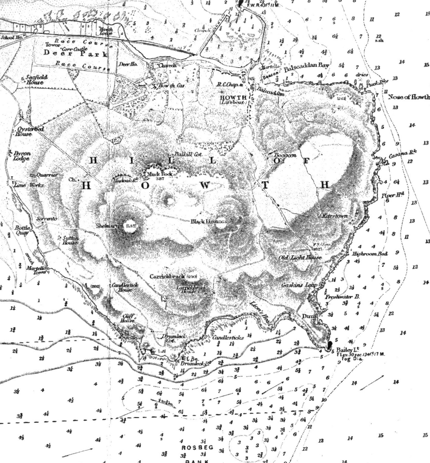
Archivo: Howth Head by Dublin, (UK) Admiralty Chart of 1875 updated to 1931, copyright expired 1981
Description: Howth Head, the peninsula at the north of Dublin Bay, as surveyed by the UK Admiralty, showing high points including Black Linn, Shelmartin and Carrickbrack, Howth village and harbour, and Estate, major buildings, roads, and various natural and nautical features, including sea depths. Public domain, scanned by contributor.
Title: Howth Head by Dublin, (UK) Admiralty Chart of 1875 updated to 1931, copyright expired 1981
Credit: Scan of part of Admiralty Chart (UK) of Dublin Bay - survey of 1875, updated to 1931
Author: UK Government
Permission: This work created by the United Kingdom Government is in the public domain. This is because it is one of the following: It is a photograph taken prior to 1 June 1957; or It was published prior to 1971; or It is an artistic work other than a photograph or engraving (e.g. a painting) which was created prior to 1971. HMSO has declared that the expiry of Crown Copyrights applies worldwide (ref: HMSO Email Reply) More information. See also Copyright and Crown copyright artistic works.
Usage Terms: Public domain
License: Public domain
Attribution Required?: No
Usos del archivo
La siguiente página enlaza a este archivo:
_Admiralty_Chart_of_1875_updated_to_1931,_copyright_expired_1981.jpg&oldid=2357319)

_Admiralty_Chart_of_1875_updated_to_1931,_copyright_expired_1981.jpg)