
Archivo: Houston-Baytown-Huntsville CSA
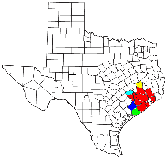
Descripción: Locator map of the Houston-The Woodlands Combined Statistical Area in the southeastern part of the U.S. state of Texas. The five components of the CSA are colored separately: Houston-The Woodlands-Sugar Land Metropolitan Statistical Area: red Huntsville Micropolitan Statistical Area: yellow El Campo Micropolitan Statistical Area: blue Bay City Micropolitan Statistical Area: light green Brenham Micropolitan Statistical Area: light blue
Título: Houston-Baytown-Huntsville CSA
Créditos: Modified from this United States Census Bureau file, based on this Census definitions list.
Autor(a): User:Nyttend, Yassie (discusión)
Permiso: US Government work is public domain. Nyttend's work was released into public domain on July 26, 2008. I, Yassie, hereby release my modified work into public domain, too, on January 21, 2018.
Términos de Uso: Dominio Público
Licencia: Dominio Público
¿Se exige la atribución?: No
Usos del archivo
La siguiente página enlaza a este archivo:
