
Archivo: Hot Water Ahead for Hurricane Irma
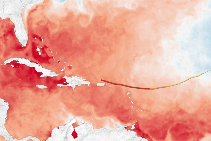
Descripción: The map above shows sea surface temperatures in the Atlantic Ocean, Caribbean Sea, and Gulf of Mexico on September 5, 2017. The data were compiled by Coral Reef Watch, which blends observations from the Suomi NPP, MTSAT, Meteosat, and GOES satellites and computer models. The mid-point of the color scale is 27.8°C, a threshold that scientists generally believe to be warm enough to fuel a hurricane. The yellow-to-red line on the map represents Irma’s track from September 3–6.
Título: Hot Water Ahead for Hurricane Irma
Créditos: https://eoimages.gsfc.nasa.gov/images/imagerecords/90000/90912/irma_crw_2017248_lrg.png
Autor(a): NASA
Términos de Uso: Dominio Público
Licencia: Dominio Público
¿Se exige la atribución?: No
Usos del archivo
La siguiente página enlaza a este archivo:
