
Archivo: Honey Hill Battlefield South Carolina
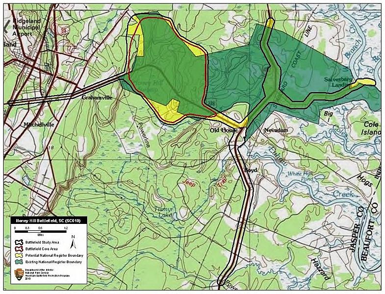
Descripción: Map of battlefield core and study areas. The ABPP revised the 1993 Study Area to include several misdirected routes used by US forces while attempting to locate and destroy the Charleston & Savannah Railroad near Grahamville. The ABPP included these routes as part of the Study Area because this activity exhausted Federal troops and delayed their arrival at Honey Hill, providing Confederate forces extra time to prepare for battle. The Confederate approach route from the railroad to the engagement area was also included in the Study Area. The ABPP expanded the Core Area’s southern boundary to include the Euhaw Creek causeway where Confederate forces bombarded Federal forces attempting to cross the creek. Along the northern edge, the ABPP reduced the Core Area to better represent the range of Federal artillery positioned along Wood Road.
Título: Honey Hill Battlefield South Carolina
Créditos: National Park Service
Autor(a): American Battlefield Protection Program
Términos de Uso: Dominio Público
Licencia: Dominio Público
¿Se exige la atribución?: No
Usos del archivo
La siguiente página enlaza a este archivo:
