Archivo: Honduras rel 1985

Tamaño de esta previsualización: 743 × 600 píxeles. Otras resoluciones: 297 × 240 píxeles | 1188 × 959 píxeles.
Archivo original (1188 × 959 píxeles; tamaño de archivo: 240 KB; tipo MIME: image/jpeg)
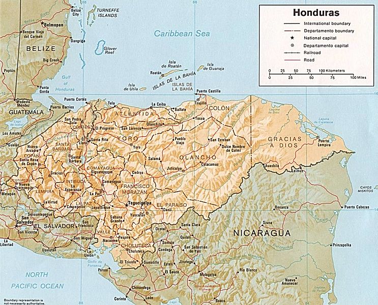
Description: Shaded relief map of Honduras, in year 1985, showing more than 45 Honduras towns, plus 40 bordering towns, in original JPEG format, 1249 x 1033 pixel, 246kb (labeled for large resizing > 600px width).
Title: Honduras rel 1985
Credit: Image source URL: http://www.lib.utexas.edu/maps/americas/honduras.jpg; there was no copyright restriction on the containing webpage of the UT Library: UT Perry-Castañeda Library Map Collection - Honduras Maps.
Author: US CIA (archived by UT Library)
Usage Terms: Public domain
License: Public domain
Attribution Required?: No
Usos del archivo
La siguiente página enlaza a este archivo:

Todo el contenido de los artículos de la Enciclopedia Kiddle (incluidas las imágenes) se puede utilizar libremente para fines personales y educativos bajo la licencia Atribución-CompartirIgual a menos que se indique lo contrario.
