
Archivo: Hermine 2010 track
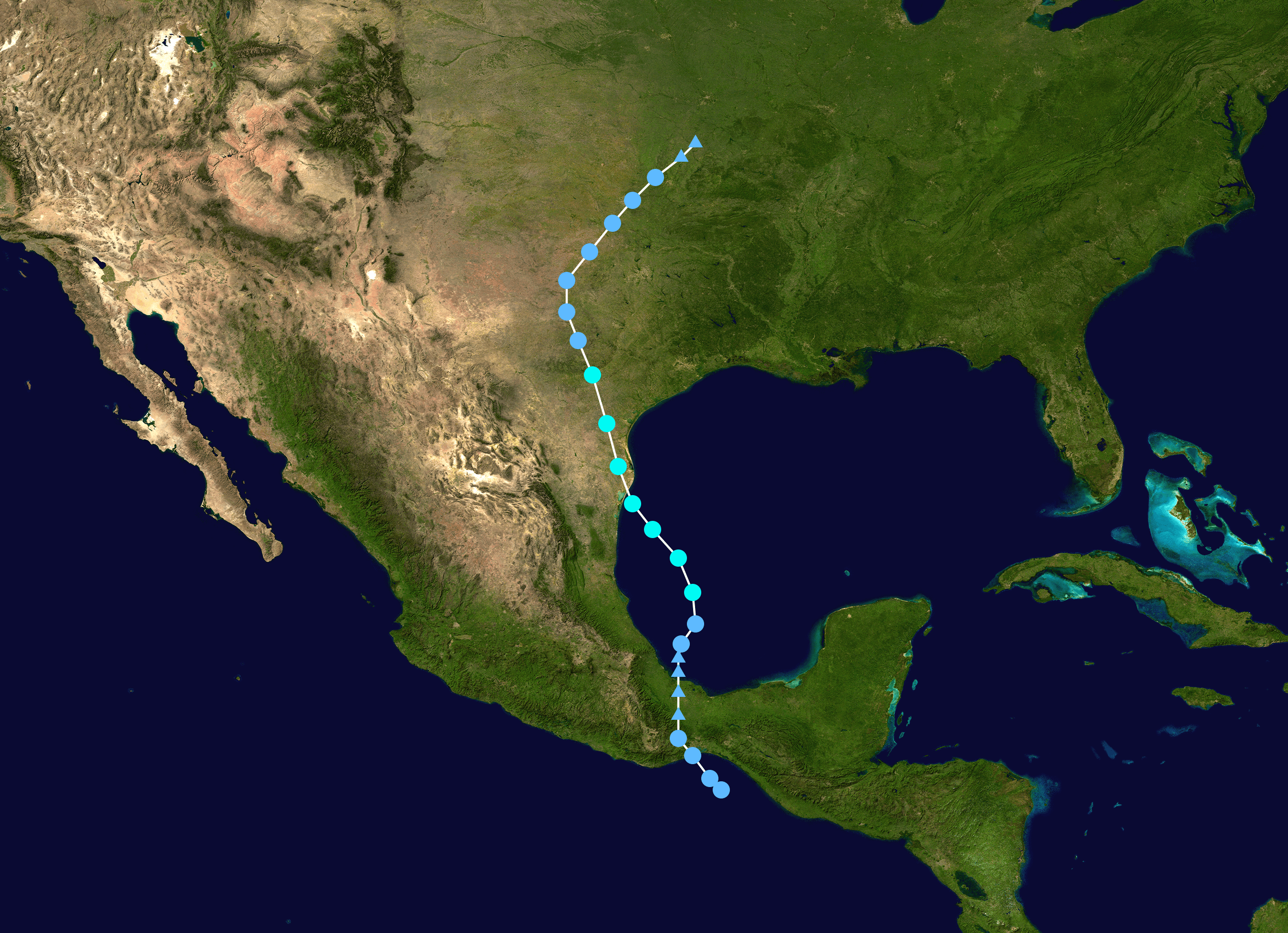
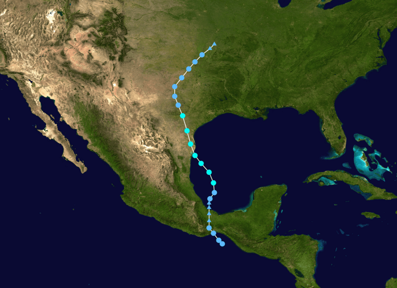
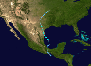
Description: Track map of Tropical Storm Hermine of the 2010 Atlantic hurricane season. The points show the location of the storm at 6-hour intervals. The colour represents the storm's maximum sustained wind speeds as classified in the Saffir-Simpson Hurricane Scale (see below), and the shape of the data points represent the nature of the storm, according to the legend below. Saffir–Simpson hurricane wind scale Tropical depression ≤38 mph ≤62 km/h Category 3 111–129 mph 178–208 km/h Tropical storm 39–73 mph 63–118 km/h Category 4 130–156 mph 209–251 km/h Category 1 74–95 mph 119–153 km/h Category 5 ≥157 mph ≥252 km/h Category 2 96–110 mph 154–177 km/h Unknown Storm type Tropical cyclone Subtropical cyclone Extratropical cyclone / Remnant low / Tropical disturbance
Title: Hermine 2010 track
Credit: Created by Titoxd using Wikipedia:WikiProject Tropical cyclones/Tracks. The background image is from NASA. Tracking data from the National Hurricane Center's running best track.[1]
Author: Titoxd
Usage Terms: Public domain
License: Public domain
Attribution Required?: No
Usos del archivo
La siguiente página enlaza a este archivo:
