
Archivo: Han dynasty Kingdoms 195 BC

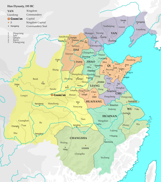
Descripción: The map represents the situation of Western Han dynasty in the 12th year of Emperor Gao (195 BC). 10 kingdoms existed within the Han empire at the time, and with the exception of Changsha, all are headed by members of the imperial family. 15 commanderies in the central and western parts of the empire were directly administered by the imperial government. The borders are based on Zhou Zhenhe's Xihan Zhengqu Dili (西汉政区地理, "Administrative Geography of Western Han"), 1987.
Título: Han dynasty Kingdoms 195 BC
Créditos: Trabajo propio, based on Zhou Zhenhe (1987). Xihan Zhengqu Dili [Administrative Geography of the Western Han Dynasty] (in Chinese). Beijing: People's Press. ISBN 9787100128988, pp. 11–15.
Autor(a): Esiymbro
Términos de Uso: Creative Commons Attribution-Share Alike 4.0
Licencia: CC BY-SA 4.0
Enlace de Licencia: https://creativecommons.org/licenses/by-sa/4.0
¿Se exige la atribución?: Sí
Usos del archivo
La siguiente página enlaza a este archivo:
