
Archivo: HORSESHOE BASIN 1.0MEG
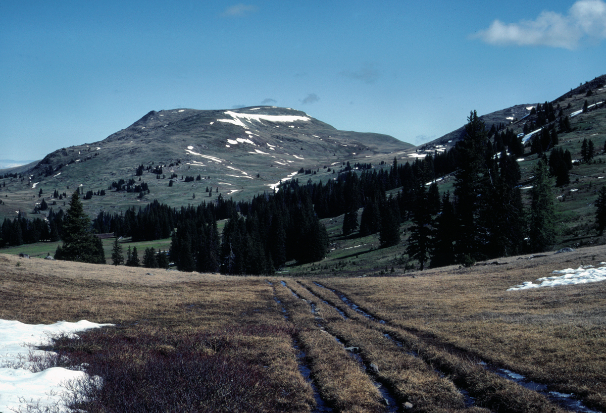
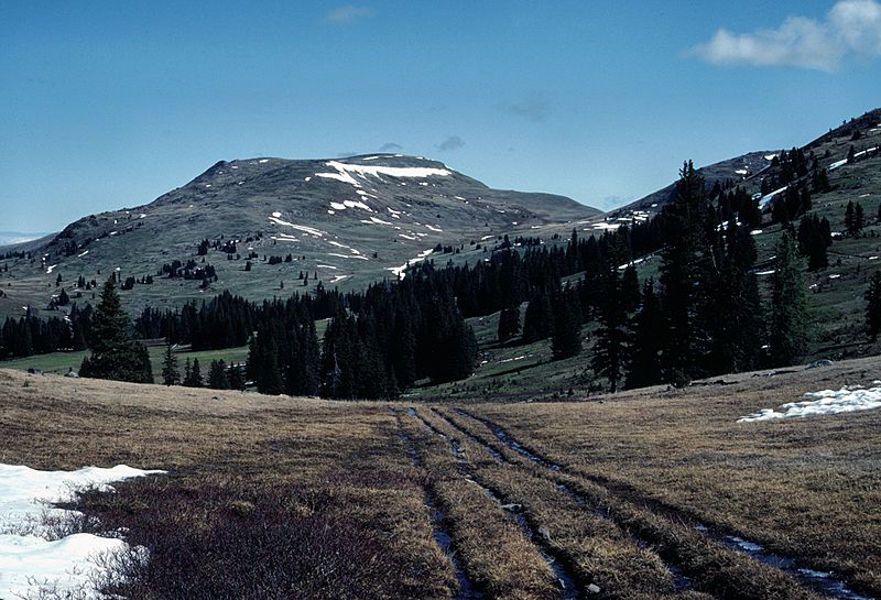
Description: This is the view from Sunny Pass, at the edge of Horseshoe Basin, 8100 foot Armstrong Peak rising in the distance. The ruts are the remnants of the old Tungsten Mine Road which provided access to the Tungsten Mine, about 17 miles to the west, which was active into the 1950's. At this point, the old road veers off to the left, while the Boundary Trail goes off to the right, traversing under Armstrong peak. The Trail continues about 50 miles to the West, along the US-Canadian border until it meets the Cascade Crest trail, well north of Hart's Pass.
Title: HORSESHOE BASIN 1.0MEG
Credit: Own work
Author: Nwcamera1
Usage Terms: Creative Commons Attribution-Share Alike 4.0
License: CC BY-SA 4.0
License Link: https://creativecommons.org/licenses/by-sa/4.0
Attribution Required?: Yes
Usos del archivo
La siguiente página enlaza a este archivo:
