
Archivo: Gwadar satellite view
Tamaño de esta previsualización: 600 × 600 píxeles. Otras resoluciones: 240 × 240 píxeles | 2000 × 2000 píxeles.
Archivo original (2000 × 2000 píxeles; tamaño de archivo: 636 KB; tipo MIME: image/jpeg)
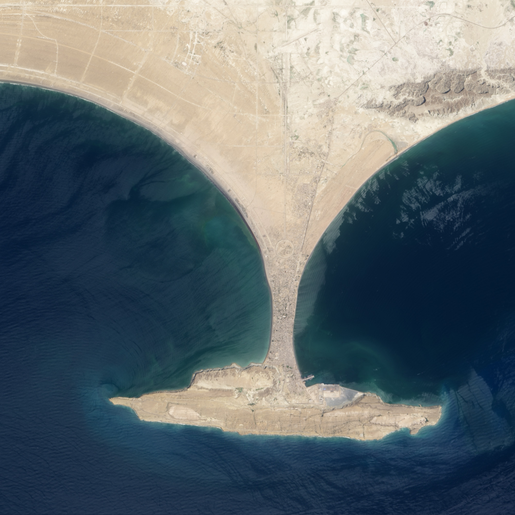
Description: This image shows the area before Zalzala Jazeera (Earthquake Island) surfaced in the upper left quadrant of this image of Gwadar, Pakistan. File:Gwadar satellite view showing island created by 2013 earthquake.jpg shows the same view with the island.
Title: Gwadar satellite view
Credit: http://earthobservatory.nasa.gov/NaturalHazards/view.php?id=82146
Author: NASA
Usage Terms: Public domain
License: Public domain
Attribution Required?: No
Usos del archivo
Las siguientes páginas enlazan a este archivo:

Todo el contenido de los artículos de la Enciclopedia Kiddle (incluidas las imágenes) se puede utilizar libremente para fines personales y educativos bajo la licencia Atribución-CompartirIgual a menos que se indique lo contrario.