
Archivo: Guelph Downtown Aerial
Tamaño de esta previsualización: 800 × 581 píxeles. Otras resoluciones: 320 × 232 píxeles | 2000 × 1453 píxeles.
Archivo original (2000 × 1453 píxeles; tamaño de archivo: 2,39 MB; tipo MIME: image/jpeg)
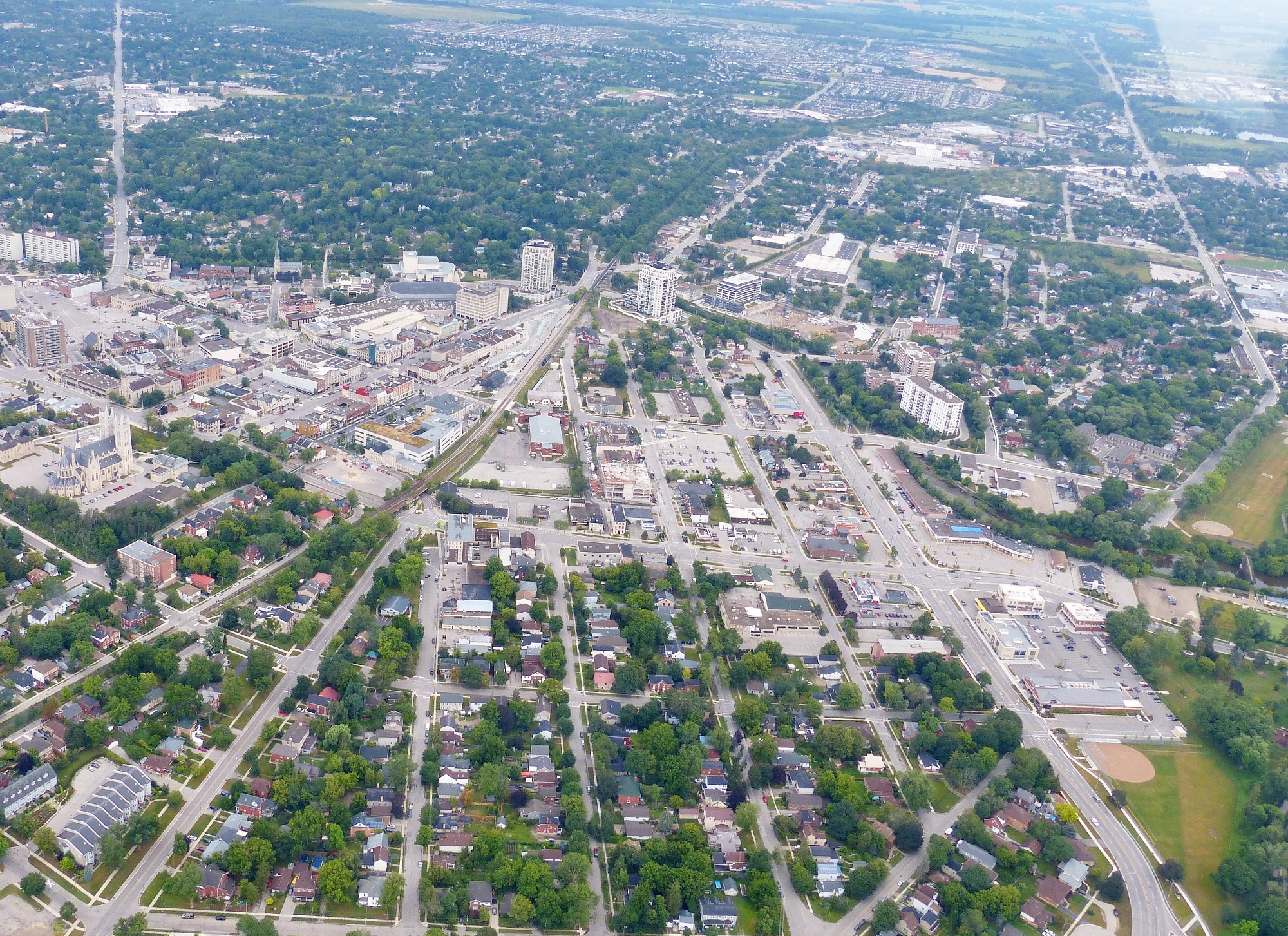
Description: Downtown Guelph from the air. The evolution of John Galt's radial street plan is evident. The road in the upper left of frame is Eramosa Road, which heads due north. At the right is York Road, Highway 7, that heads towards Rockwood. The four lane road on the lower right is Wellington Street. The photo was taken from a Cessna 152 C-FQZB owned by pilot Bill Carius.
Title: Guelph Downtown Aerial
Credit: Own work
Author: J. S. (Steve) Bond
Usage Terms: Creative Commons Attribution-Share Alike 4.0
License: CC BY-SA 4.0
License Link: https://creativecommons.org/licenses/by-sa/4.0
Attribution Required?: Yes
Usos del archivo
La siguiente página enlaza a este archivo:

Todo el contenido de los artículos de la Enciclopedia Kiddle (incluidas las imágenes) se puede utilizar libremente para fines personales y educativos bajo la licencia Atribución-CompartirIgual a menos que se indique lo contrario.