
Archivo: Guayaneco
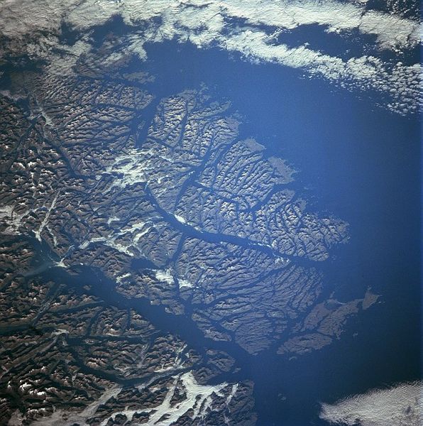
Descripción: Guayaneco Archipelago, Chile - June 1998 NASA says: The islands of the Guayaneco Archipelago can be seen in this southwest-looking view. The Guayaneco Archipelago was heavily glaciated during the most recent ice age. These glaciers dissected these mountain islands into a series of deep river valleys and glacial troughs. Today these glacial troughs are deep channels and fjords. The islands of the Guayaneco Archipelago comprise a series of elongated islands and deep bays that are the traces of a drowned coastal range. A number of deep channels are visible traversing generally north to south through the islands. These include the Messier Channel in the lower left portion of the image, and the Fallos Channel near the center of the image. The Pacific Ocean covers most of the upper center and upper right portion of the image. Forests cover the lower slopes of the mountains throughout the many islands. Human settlement on these islands is scarce.
Título: Guayaneco
Créditos: http://eol.jsc.nasa.gov/sseop/EFS/photoinfo.pl?PHOTO=STS091-729-4
Autor(a): NASA
Términos de Uso: Dominio Público
Licencia: Dominio Público
¿Se exige la atribución?: No
Usos del archivo
Las siguientes páginas enlazan a este archivo:
