
Archivo: Ghana successor map 1200-es

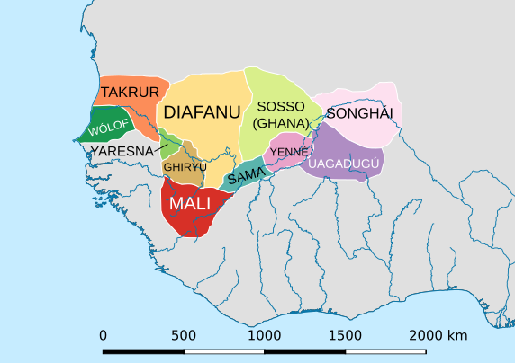
Descripción: Map of the successor states of the Ghana Empire, on the upper Niger river valley, West Africa, circa 1200 Common Era. These outlines are approximate, and should not suggest modern states with fixed borders. States in this era were centered around cities and strong places, with variations of influence radiating out from these points. C. 1200 on the eve of the rise of the Mali Empire, usually dated in the 1240s CE.
Título: Ghana successor map 1200-es
Créditos: WestAfrica1350.png WestAfrica1625-es.svg
Autor(a): WestAfrica1350.png: Gabagool (discusión · contribs.) WestAfrica1625-es.svg: Rowanwindwhistler (discusión · contribs.) derivative work: Rowanwindwhistler (discusión)
Términos de Uso: Creative Commons Attribution-Share Alike 3.0
Licencia: CC BY-SA 3.0
Enlace de Licencia: https://creativecommons.org/licenses/by-sa/3.0
¿Se exige la atribución?: Sí
Usos del archivo
La siguiente página enlaza a este archivo:
