
Archivo: Galapagos Islands topographic map-fr

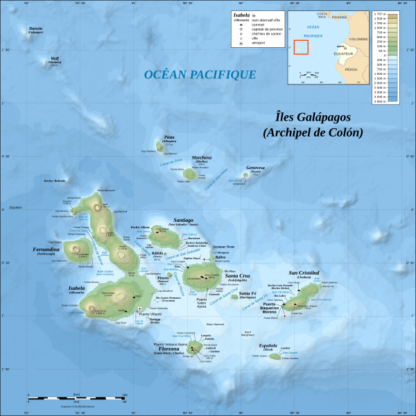
Descripción: Topographic and bathymetric map of the Galápagos Islands, Ecuador.
Título: Galapagos Islands topographic map-fr
Créditos: Own work Data sources: Topography: NASA SRTM3 v2 Bathymetry: compiled by William Chadwick, Oregon State University (see the terms of use)
Autor(a): Eric Gaba (Sting - fr:Sting)
Permiso: Attribution and Share-Alike required Any use of this map can be made as long as you credit me (Eric Gaba – Wikimedia Commons user: Sting) as the author, William Chadwick, Oregon State University, for the compilation of the bathymetry, and distribute the copies and derivative works under the same license(s) that the one(s) stated below. A message with a reply address would also be greatly appreciated.
Términos de Uso: Creative Commons Attribution-Share Alike 4.0
Licencia: CC BY-SA 4.0
Enlace de Licencia: https://creativecommons.org/licenses/by-sa/4.0
¿Se exige la atribución?: Sí
Usos del archivo
Las siguientes páginas enlazan a este archivo:
