
Archivo: Galapagos-satellite-2002
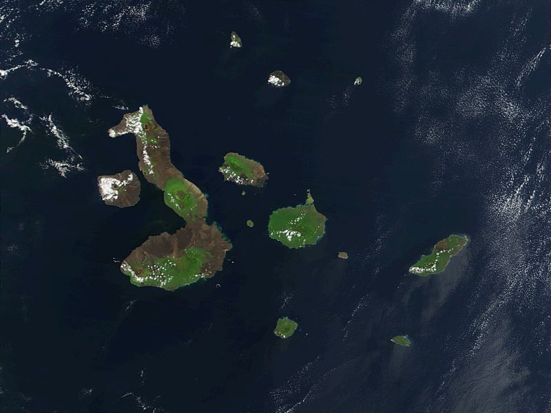
Descripción: This true-color image of the Galapagos Islands was acquired on March 12, 2002, by the Moderate-resolution Imaging Spectroradiometer (MODIS), flying aboard NASA's Terra satellite. The Galapagos Islands, which are part of Ecuador, sit in the Pacific Ocean about 1000 km (620 miles) west of South America. As the three craters on the largest island (Isabela Island) suggest, the archipelago was created by volcanic eruptions, which took place millions of years ago.
Título: Galapagos-satellite-2002
Créditos: Earth Observatory 8270 and NASA GSFC
Autor(a): Jacques Descloitres, MODIS Rapid Response Project at NASA/GSFC
Términos de Uso: Dominio Público
Licencia: Dominio Público
¿Se exige la atribución?: No
Usos del archivo
Las siguientes páginas enlazan a este archivo:
