
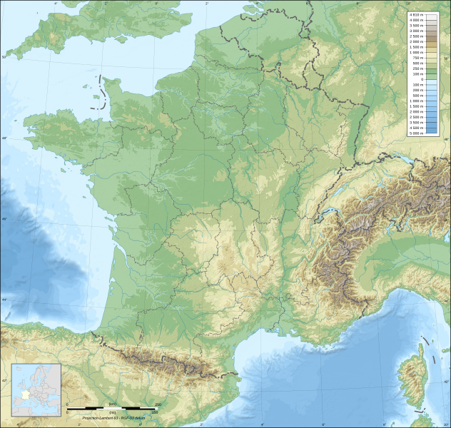
Archivo: France map Lambert-93 topographic with regions-blank

Descripción: Blank topographic map of France in the official Lambert-93 projection, with regions boundaries. Note: The background map is a raster image embedded in the SVG file.
Título: France map Lambert-93 topographic with regions-blank
Créditos: Own work Sources of data: Topography: NASA SRTM30 (public domain); Bathymetry: NGDC ETOPO1 (public domain); Additional data: NGDC World Data Bank II (public domain).
Autor(a): Eric Gaba (Sting - fr:Sting)
Permiso: Attribution and Share-Alike required Any use of this map can be made as long as you credit me (Eric Gaba – Wikimedia Commons user: Sting) as the author and distribute the copies and derivative works under the same license(s) that the one(s) stated below. A message with a reply address would also be greatly appreciated.
Términos de Uso: Creative Commons Attribution-Share Alike 4.0
Licencia: CC BY-SA 4.0
Enlace de Licencia: https://creativecommons.org/licenses/by-sa/4.0
¿Se exige la atribución?: Sí
Usos del archivo
La siguiente página enlaza a este archivo:
