
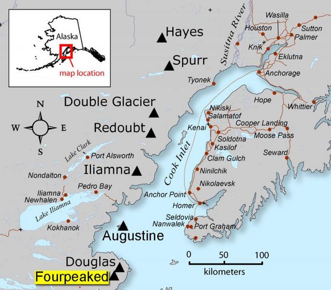
Archivo: Fourpeaked-map1

Tamaño de esta previsualización: 684 × 599 píxeles. Otras resoluciones: 274 × 240 píxeles | 800 × 701 píxeles.
Archivo original (800 × 701 píxeles; tamaño de archivo: 82 KB; tipo MIME: image/jpeg)
Description: AVO map shows the location of Fourpeaked volcano
Title: Fourpeaked-map1
Credit: Map created by Seth Snedigar and Janet Schaafer for the United States Geological Survey's Alaska Volcano Observatory and the Alaska Division of Geological & Geophysical Surveys
Author: Seth Snedigar and Janet Schaafer for the United States Geological Survey's Alaska Volcano Observatory and the Alaska Division of Geological & Geophysical Surveys
Usage Terms: Public domain
License: Public domain
Attribution Required?: No
Usos del archivo
La siguiente página enlaza a este archivo:

Todo el contenido de los artículos de la Enciclopedia Kiddle (incluidas las imágenes) se puede utilizar libremente para fines personales y educativos bajo la licencia Atribución-CompartirIgual a menos que se indique lo contrario.