
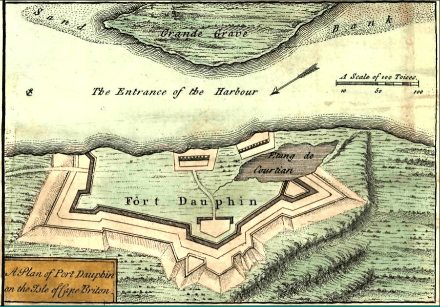
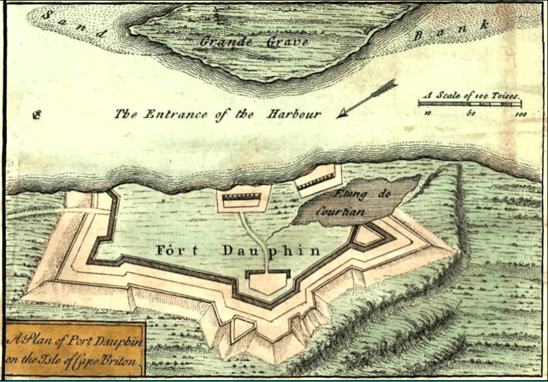
Archivo: FortDaupinCapeBreton (inset) A new and accurate map of the English empire in North America, 1755
Tamaño de esta previsualización: 800 × 558 píxeles. Otras resoluciones: 320 × 223 píxeles | 901 × 629 píxeles.
Archivo original (901 × 629 píxeles; tamaño de archivo: 1,02 MB; tipo MIME: image/png)
Description: A new and accurate map of the English empire in North America; Representing their rightful claim as confirmed by charters and the formal surrender of their Indian friends; likewise the encroachments of the French, with the several forts they have unjustly erected therein.
Title: FortDaupinCapeBreton (inset) A new and accurate map of the English empire in North America, 1755
Credit: http://memory.loc.gov/cgi-bin/query/h?ammem/gmd:@field(NUMBER+@band(g3300+ar006200))
Author: London, Sold by Wm. Herbert ... , 1755.
Usage Terms: Public domain
License: Public domain
Attribution Required?: No
Usos del archivo
La siguiente página enlaza a este archivo:
_A_new_and_accurate_map_of_the_English_empire_in_North_America,_1755.png&oldid=2310281)

Todo el contenido de los artículos de la Enciclopedia Kiddle (incluidas las imágenes) se puede utilizar libremente para fines personales y educativos bajo la licencia Atribución-CompartirIgual a menos que se indique lo contrario.
_A_new_and_accurate_map_of_the_English_empire_in_North_America,_1755.png)