
Archivo: First Fitna Map, Ali-Muawiya Phase-es

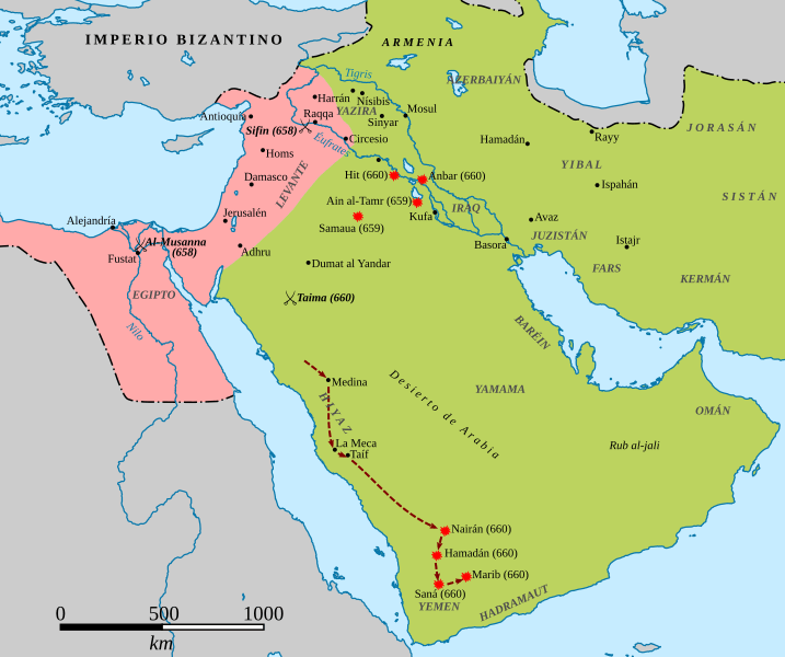
Descripción: Map of the conflict between Caliph Ali (r. 656-661) and Governor of Syria Mu'awiya ibn Abi Sufyan during the First Muslim Civil War. The area shaded in green represents the territories of the Caliphate under Ali's control following the capture of Egypt by Mu'awiya's ally and deputy Amr ibn al-As in 658; the area in shaded in pink represents Mu'awiya's domains. Battles, raids by Mu'awiya's lieutenants and the military expedition route of Mu'awiya's lieutenant Busr ibn Abi Artat are all indicated. The frontiers of the Caliphate are approximate. Sources: Madelung, Wilferd (1997). The Succession to Muhammad: A Study of the Early Caliphate. Cambridge: Cambridge University Press. ISBN 0-521-56181-7, pages 184–310.
Título: First Fitna Map, Ali-Muawiya Phase-es
Créditos: https://commons.wikimedia.org/wiki/File:First_Fitna_Map,_Ali-Muawiya_Phase.png
Autor(a): Al Ameer son
Términos de Uso: Creative Commons Attribution-Share Alike 4.0
Licencia: CC BY-SA 4.0
Enlace de Licencia: https://creativecommons.org/licenses/by-sa/4.0
¿Se exige la atribución?: Sí
Usos del archivo
La siguiente página enlaza a este archivo:
