
Archivo: Eq-prob
Tamaño de esta previsualización: 448 × 600 píxeles. Otras resoluciones: 179 × 240 píxeles | 535 × 716 píxeles.
Archivo original (535 × 716 píxeles; tamaño de archivo: 150 KB; tipo MIME: image/jpeg)
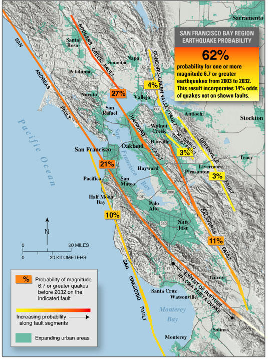
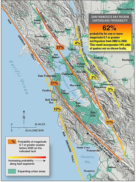
Description: en:USGS seismic hazard map showing the probability of an M6.7 or greater earthquake occurring in the en:San Francisco Bay Area between en:2003 and en:2032. Recent (January 2008) assessments (San Jose Mercury News: Hayward fault might be more dangerous than scientists thought ) suggest that the Hayward, Rodgers Creek, and northern Calaveras faults may be more likely to fail in the next few decades than previously thought (more so than is indicated on this map).
Title: Eq-prob
Usage Terms: Public domain
License: Public domain
Attribution Required?: No
Usos del archivo
La siguiente página enlaza a este archivo:

Todo el contenido de los artículos de la Enciclopedia Kiddle (incluidas las imágenes) se puede utilizar libremente para fines personales y educativos bajo la licencia Atribución-CompartirIgual a menos que se indique lo contrario.