
Archivo: English metropolitan boroughs 2009

Tamaño de esta previsualización PNG del archivo SVG: 494 × 600 píxeles. Otra resolución: 198 × 240 píxeles.
Archivo original (archivo SVG, nominalmente 1108 × 1345 píxeles, tamaño de archivo: 376 KB)
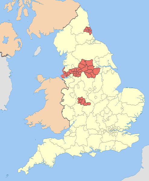
Description: Map highlighting the metropolitan boroughs of England from 2009. (Still valid in 2012.) 00 metropolitan borough Equirectangular map projection on WGS 84 datum, with N/S stretched 170% Geographic limits: West: 6.75W East: 2.0E North: 56.0N South: 49.75N
Title: English metropolitan boroughs 2009
Credit: This file was derived from: English administrative divisions 2010.svg:
Author: English_administrative_divisions_2010.svg: Nilfanion derivative work: Dr Greg
Usage Terms: Creative Commons Attribution-Share Alike 3.0
License: CC BY-SA 3.0
License Link: https://creativecommons.org/licenses/by-sa/3.0
Attribution Required?: Yes
Usos del archivo
La siguiente página enlaza a este archivo:

Todo el contenido de los artículos de la Enciclopedia Kiddle (incluidas las imágenes) se puede utilizar libremente para fines personales y educativos bajo la licencia Atribución-CompartirIgual a menos que se indique lo contrario.