
Archivo: Empire of the Kökturks
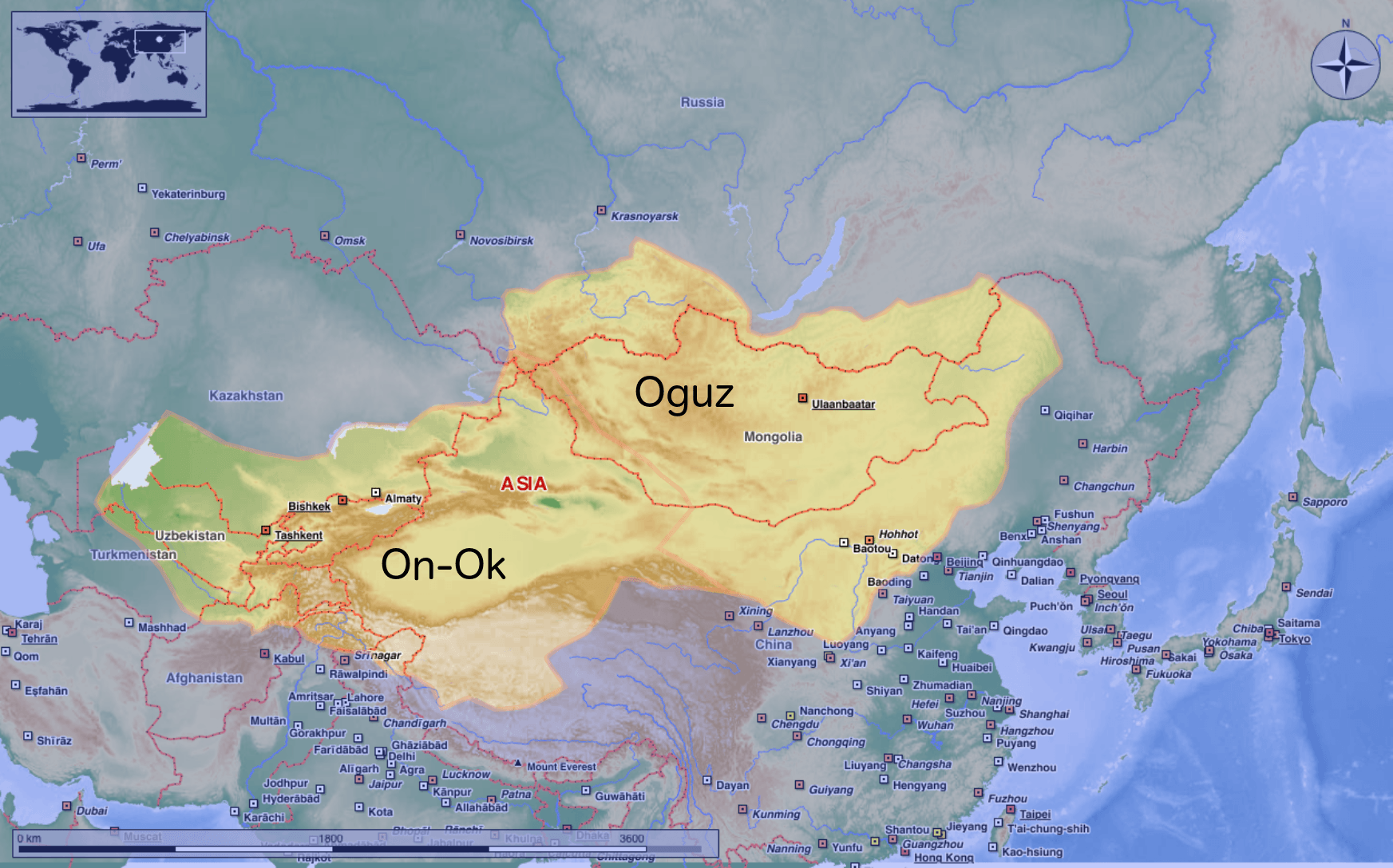
Descripción: This map shows the kingdom of Kökturks after the division of the kingdom in 552. The grey area shows the area of On-Ok or the western Kökturks. The white area shows the area of the eastern Kökturk. This area was still in the sixth Century a Chinese protectorate. 745 the Kökturks were part of the Uyghur empire. After 840 Kökturks and the Uyghurs were conquered by the Kyrgyz. The source of this map: "Der große Atlas Weltgeschichte", Orbis Verlag 1990, ISBN 3-572-04755-2, P. 47 & 51
Título: Empire of the Kökturks
Créditos: Trabajo propio
Autor(a): Hardcore-Mike
Términos de Uso: Creative Commons Attribution 3.0
Licencia: CC BY 3.0
Enlace de Licencia: https://creativecommons.org/licenses/by/3.0
¿Se exige la atribución?: Sí
Usos del archivo
La siguiente página enlaza a este archivo:
