
Archivo: Empire of the Göktürks
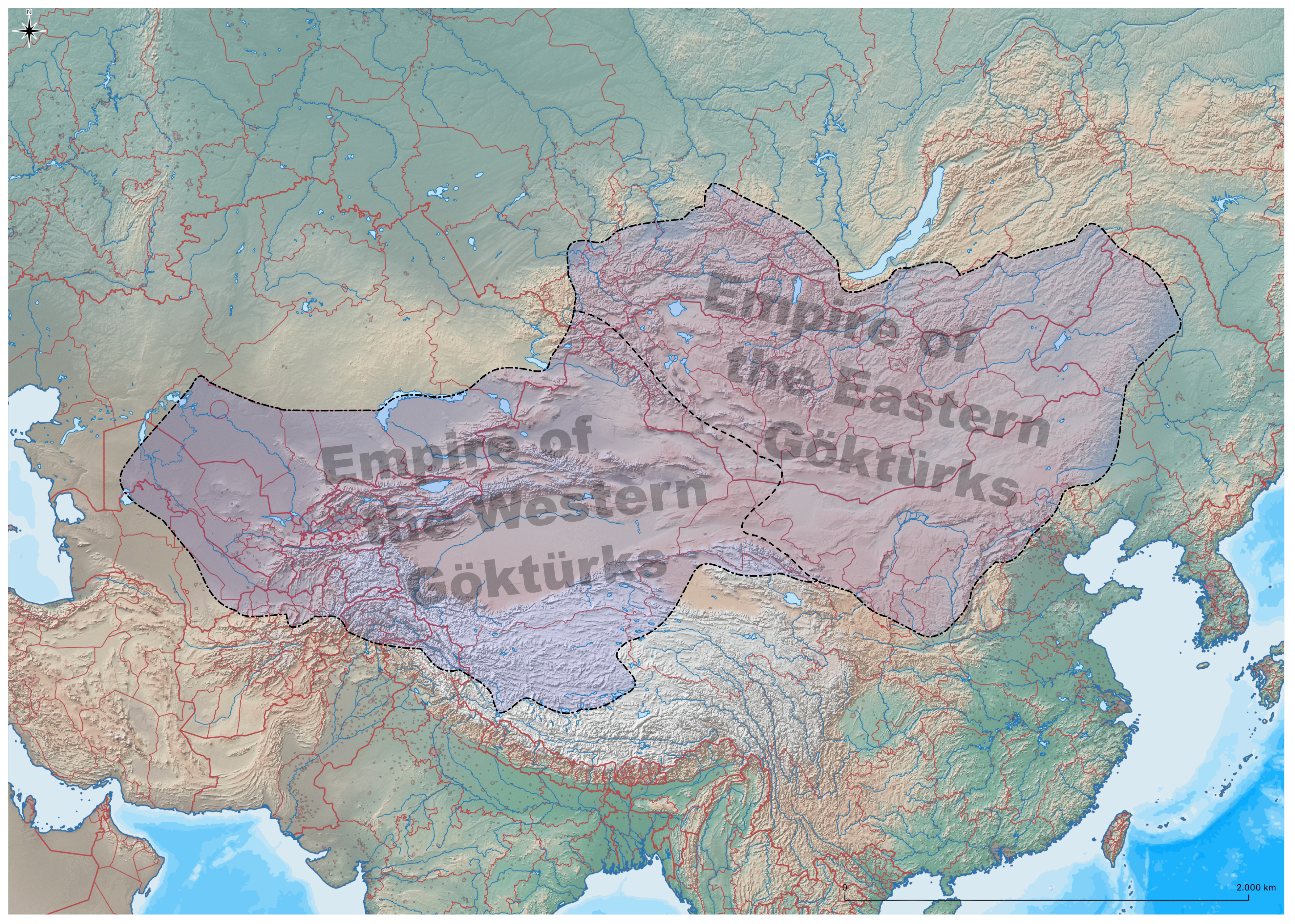
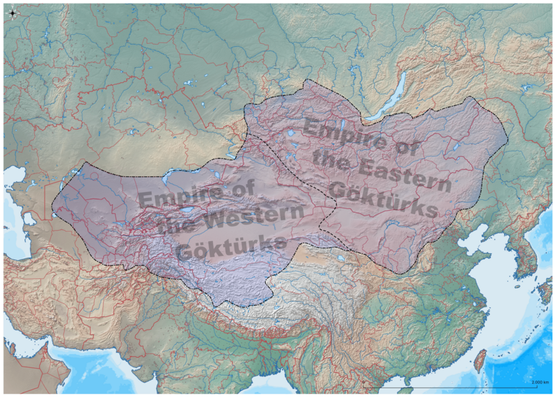
Descripción: This map shows the Empire of the Göktürks after the division of the khanate in 552. The western area of the Western Göktürks was also known as the “Khanate of the On-Ok”, while the area of the Eastern Göktürks operated under the name “Khanate of the Türk”. The Eastern Göktürks have still become a Chinese protectorate in the sixth century. 745, the Göktürks were part of the Uyghur empire. After 840, the Göktürks and the Uyghurs were conquered by the Kyrgyz. As is usual with all early Central Asian tribal states, it should not be overlooked that the borders at that time were not fixed, but rather fluid. It is therefore unlikely that the Göktürks actually ruled over the areas of today's Chinese province of Tibet or over northern Afghanistan. Rather, it can be assumed that these regions lived under the loose rule of the Göktürks and were obliged to pay tribute to them. The source of this map: "Der große Atlas Weltgeschichte", Orbis Verlag 1990, ISBN 3-572-04755-2, P. 47 & 51. Map extent coordinates and scale: N 8649254.2806, W 556510.1842, E 14669218.4998, S 2167000.6352, 1:124.689.24
Título: Empire of the Göktürks
Créditos: Trabajo propio, self-made, generated from public domain map data. Programs used for creation: QGIS, and Inkscape.
Autor(a): Hardcore-Mike
Términos de Uso: Creative Commons Attribution 3.0
Licencia: CC BY 3.0
Enlace de Licencia: https://creativecommons.org/licenses/by/3.0
¿Se exige la atribución?: Sí
Usos del archivo
La siguiente página enlaza a este archivo:
