
Archivo: Empire of Brazil ethnic groups (edit)
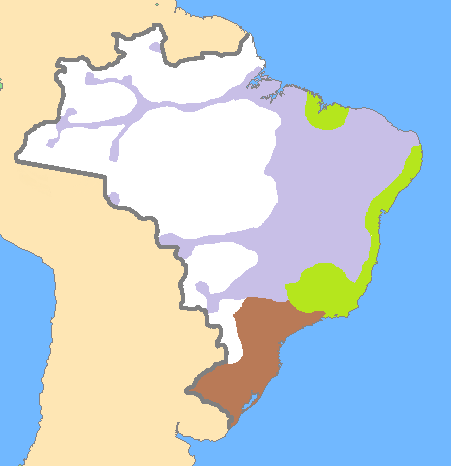
Description: Map of the Empire of Brazil (1822-1889) with aproximate human presence and boundaries of each ethnic groups and the area where each is majority. In light purple: caboclos. In light green: mulattoes. In light brown: whites. In white: uninhabited. For the distribution of people throughout the national territory, an 1889 map showing towns was used in comparison with a late 18th century map in Fausto, Boris. História do Brasil. 13 ed. São Paulo: Editora da Universidade de São Paulo, 2010 ISBN 978-85-314-0240-1
Title: Empire of Brazil ethnic groups (edit)
Credit: This file was derived from: Empire of Brazil ethnic groups.png:
Author: Empire_of_Brazil_ethnic_groups.png: Myself (Lecen), but based on map created by user j.budissin derivative work: Jbarta
Usage Terms: Public domain
License: Public domain
Attribution Required?: No
Usos del archivo
La siguiente página enlaza a este archivo:
.png&oldid=1639334)

.png)