
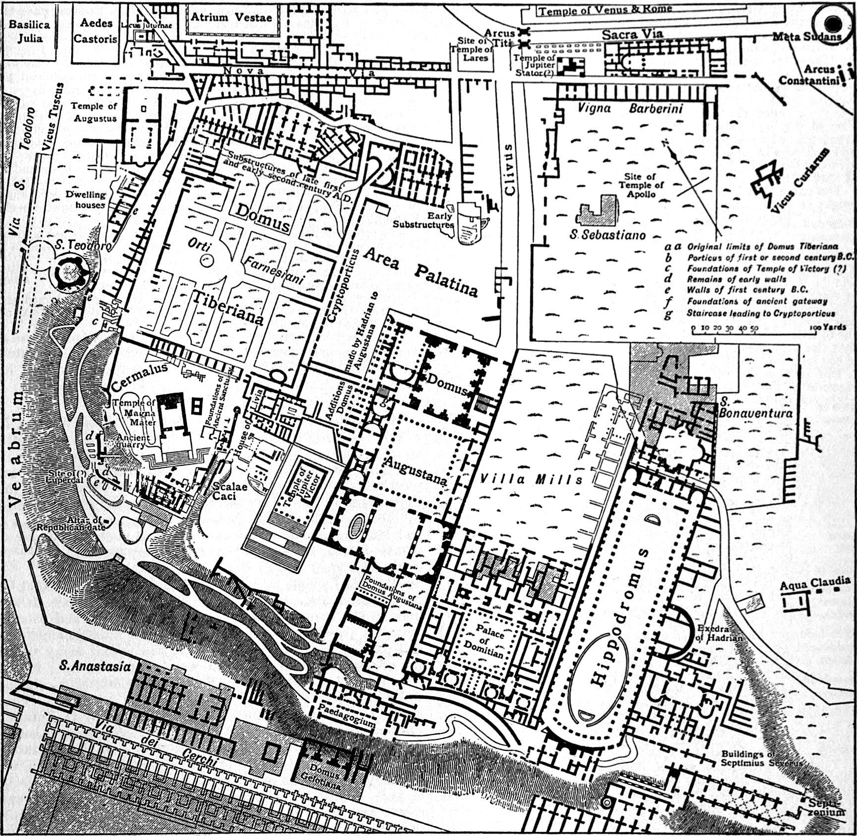
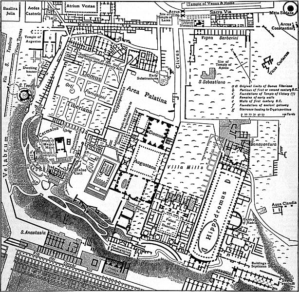
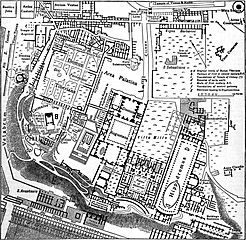
Archivo: EB1911 Rome - Plan of the Palatine
Tamaño de esta previsualización: 614 × 599 píxeles. Otras resoluciones: 246 × 240 píxeles | 1729 × 1687 píxeles.
Archivo original (1729 × 1687 píxeles; tamaño de archivo: 1,38 MB; tipo MIME: image/jpeg)
Description: Map of the Palatine in Rome.
Title: EB1911 Rome - Plan of the Palatine
Credit: Encyclopædia Britannica (11th ed.), v. 23, 1911, “Rome,” p. 599, fig. 10.
Author: From Richter's Topographie der Stadt Rom by permission of C. H. Beck'sche Verlagsbuchhandlung
Permission: This image comes from the 12th edition of the Encyclopædia Britannica or earlier. The copyrights for that book have expired in the United States because the book was first published in the US with the publication occurring before January 1, 1923. As such, this image is in the public domain in the United States.
Usage Terms: Public domain
License: Public domain
Attribution Required?: No
Usos del archivo
La siguiente página enlaza a este archivo:

Todo el contenido de los artículos de la Enciclopedia Kiddle (incluidas las imágenes) se puede utilizar libremente para fines personales y educativos bajo la licencia Atribución-CompartirIgual a menos que se indique lo contrario.