
Archivo: De Smet Council Bluffs
Tamaño de esta previsualización: 538 × 600 píxeles. Otras resoluciones: 215 × 240 píxeles | 2154 × 2401 píxeles.
Archivo original (2154 × 2401 píxeles; tamaño de archivo: 553 KB; tipo MIME: image/jpeg)
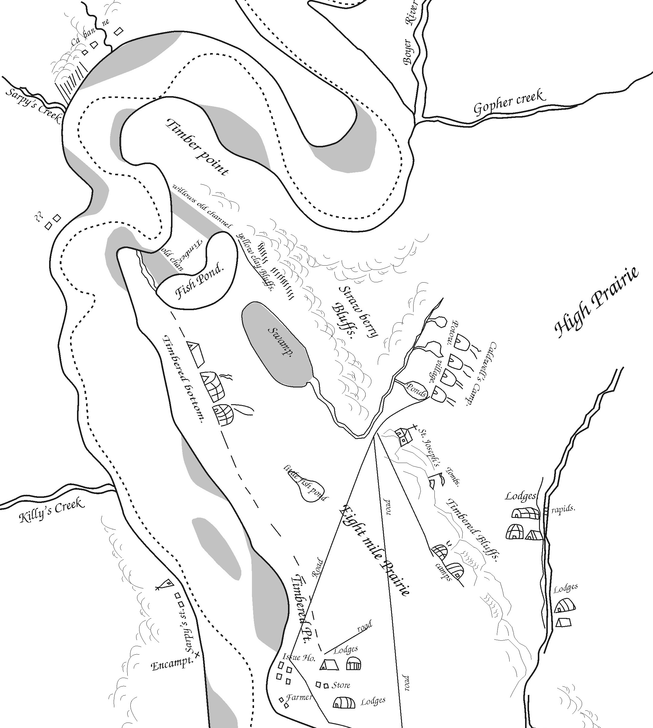
Description: A small portion of Pierre-Jean De Smet's 1839 map of the Council Bluffs Region, traced by the contributor. The area labeled "Caldwell's Camp" was probably near or just southeast of Broadway, the "Fish Pond" is Big Lake Park, and "St. Joseph's" was the Council Bluffs blockhouse.
Title: De Smet Council Bluffs
Credit: The original maps are on file in St. Louis, copies of this map have been widely published. See Journal of the Iowa Archeological Society Vol. 55 (2008) for more info.
Author: Billwhittaker (talk) 18:28, 8 December 2008 (UTC)
Usage Terms: Public domain
License: Public domain
Attribution Required?: No
Usos del archivo
Las siguientes páginas enlazan a este archivo:

Todo el contenido de los artículos de la Enciclopedia Kiddle (incluidas las imágenes) se puede utilizar libremente para fines personales y educativos bajo la licencia Atribución-CompartirIgual a menos que se indique lo contrario.