
Archivo: Countries by population density
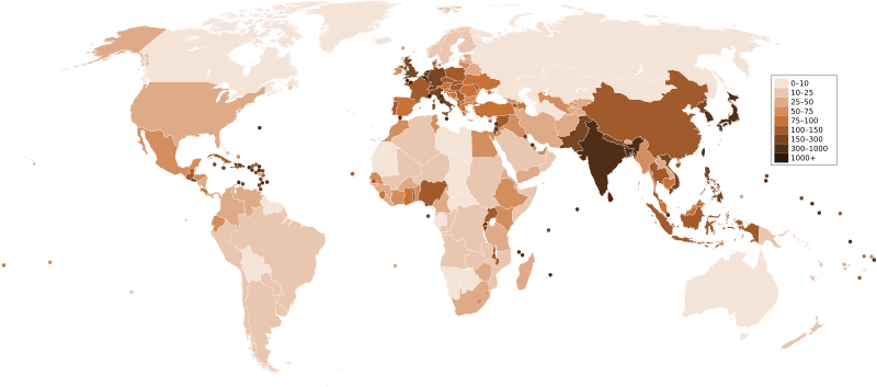
Descripción: A map of the world, with colours to highlight the population density of each country or territory. Numbers on the legend are in people per km2, and all countries smaller than 20,000 km2 are represented by a dot. The information was taken from en:Countries by population density.It is intended as a vector replacement for Image:World population density map.PNG. It is derived from Image:BlankMap-World6.svg, so thanks to everyone who has contributed to that. If you have any comments, suggestions, corrections, or requests for other maps, please contact me at my English Wikipedia talk page.
Título: Countries by population density
Créditos: Trabajo propio
Autor(a): Miguel Contreras, Guatemala
Términos de Uso: Dominio Público
Licencia: Dominio Público
¿Se exige la atribución?: No
Usos del archivo
Las siguientes páginas enlazan a este archivo:
