
Archivo: Civilizations map
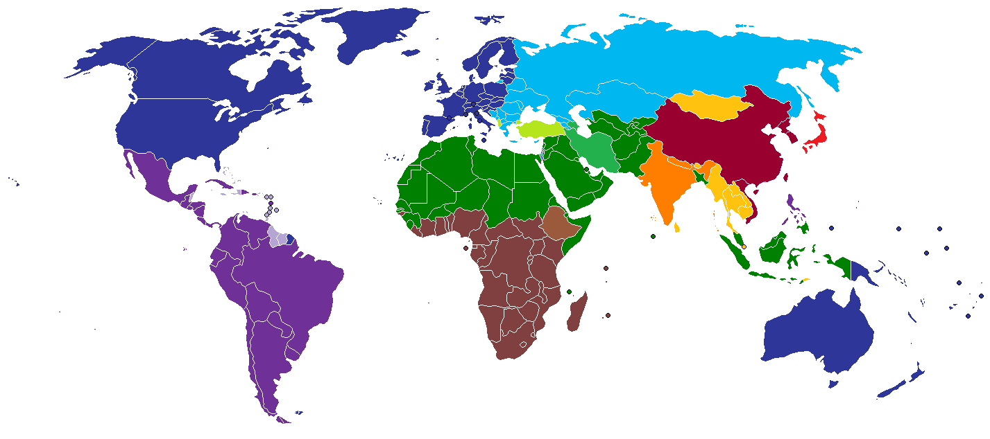
Descripción: A map of civilizations, loosely based (see below) on Huntington's 1996 "Clash of Civilizations" (p. 26). The NINE "civilizations" identified by Huntington are:
Western
Latin American
Japanese
Sinic
Hindu
Islamic (green). Note: Huntington considers Turkey and Iran to be special cases, and assigns them to its own group.
Orthodox (medium-light blue)
African (brown)
Buddhist (yellow)
Other colors should indicate (light green, turquoise) the cultural fault lines where the clash of civilizations will occur. There are nine blocks shown in the original 1996 map. The additional colors, including the "fault line" countries in light green or turquoise are due to the judgement of the uploaders/creators of this map, not to Huntington.
Other differences from the original map:
the Philippines are shown as "Sinic" on the interior but "Western" along the coastlines Israel is shown as "Western" India (The Republic of India) is shown as being "Hindu"; Nepal and Sri Lanka are also shown as "Hindu" Bosnia-Herzegovina is shown as "Orthodox" Tibet is shown as "Sinic" Southern Sudan and southern Chad are shown as "African", but northern Nigeria and Burkina Faso are shown as "Muslim"
As a consequence of these differences, this map should not be used in a context that suggests that it represents the situation as described by Huntington (1996).
Términos de Uso: Dominio Público
Usos del archivo
La siguiente página enlaza a este archivo:
