
Archivo: Chesapeakelandsat

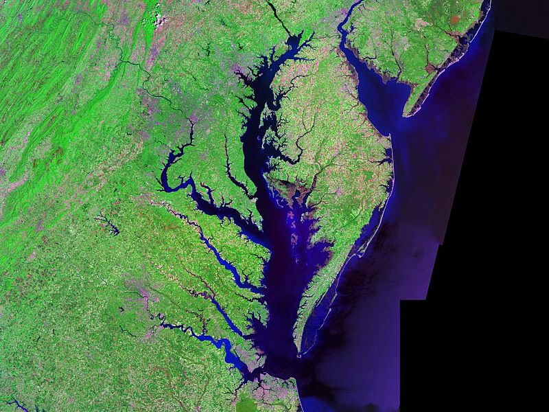
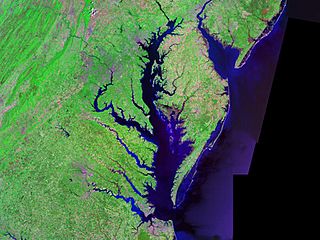
Description: Satellite (Landsat) picture of Chesapeake Bay (center) and Delaware Bay (upper right) - and Atlantic coast of the central-eastern United States.
Title: Chesapeakelandsat
Credit: Landsat photo, from circa 2000. Generated via [1] from NASA data
Author: Landsat/NASA
Permission: This work is in the public domain in the United States because it is a work prepared by an officer or employee of the United States Government as part of that person’s official duties under the terms of Title 17, Chapter 1, Section 105 of the US Code. See Copyright. Note: This only applies to original works of the Federal Government and not to the work of any individual U.S. state, territory, commonwealth, county, municipality, or any other subdivision. This template also does not apply to postage stamp designs published by the United States Postal Service since 1978. (See § 313.6(C)(1) of Compendium of U.S. Copyright Office Practices). It also does not apply to certain US coins; see The US Mint Terms of Use. This file has been identified as being free of known restrictions under copyright law, including all related and neighboring rights.
Usage Terms: Public domain
License: Public domain
Attribution Required?: No
Usos del archivo
Las siguientes páginas enlazan a este archivo:
