
Archivo: Chernyakhov

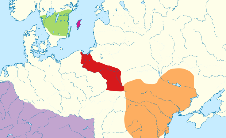
Descripción: The green area is the traditional extent of Götaland and the pink area is the island of Gotland. The red area is the extent of the Wielbark culture in the early 3rd century, and the orange area is the Chernyakhov culture, in the early 4th century. The purple area is the Roman Empire. The extent of the Wielbark culture is based on Zbigniew Babik: "Najstarsza warstwa nazewnicza na ziemiach polskich" Cracow 2001. The extent of the Chernyakhov culture is based on R. Wołągiewicz (1993), a map drawn by Lars Östlin, in Kaliff's Gothic Connections. Contacts between eastern Scandinavia and the southern Baltic coast 1000 BC – 500 AD (2001:29)
Título: Chernyakhov
Créditos: Chernyakhov.PNG Europe laea location map.svg
Autor(a): Chernyakhov.PNG: Wiglaf (discusión · contribs.),Dbachmann (discusión · contribs.) Europe laea location map.svg: Alexrk2 (discusión · contribs.) derivative work: Rowanwindwhistler (discusión) work: Rowanwindwhistler (discusión)
Términos de Uso: Creative Commons Attribution-Share Alike 3.0
Licencia: CC-BY-SA-3.0
Enlace de Licencia: http://creativecommons.org/licenses/by-sa/3.0/
¿Se exige la atribución?: Sí
Usos del archivo
La siguiente página enlaza a este archivo:
