
Archivo: Charlestonriversmap
Tamaño de esta previsualización: 600 × 600 píxeles. Otras resoluciones: 240 × 240 píxeles | 1000 × 1000 píxeles.
Archivo original (1000 × 1000 píxeles; tamaño de archivo: 395 KB; tipo MIME: image/png)
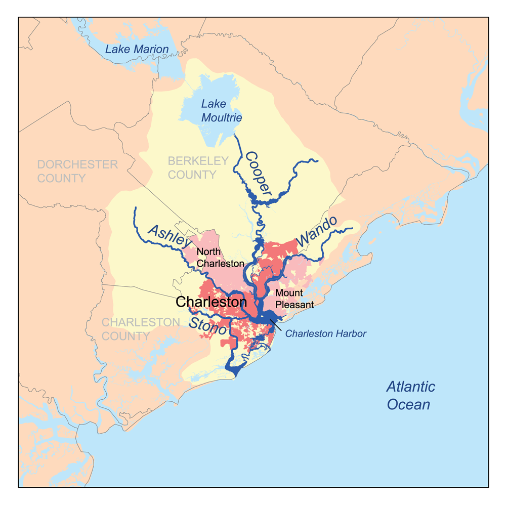
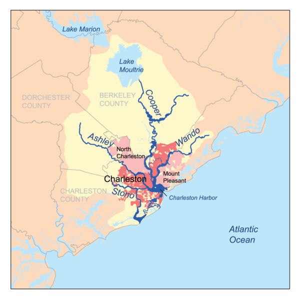
Description: This is a map of the Charleston Harbor watershed, including the Ashley, Cooper, Wando and Stono rivers. I, Karl Musser, created it based on USGS and Census Bureau data.
Title: Charlestonriversmap
Credit: No machine-readable source provided. Own work assumed (based on copyright claims).
Author: No machine-readable author provided. Kmusser assumed (based on copyright claims).
Usage Terms: Creative Commons Attribution-Share Alike 2.5
License: CC BY-SA 2.5
License Link: http://creativecommons.org/licenses/by-sa/2.5
Attribution Required?: Yes
Usos del archivo
La siguiente página enlaza a este archivo:

Todo el contenido de los artículos de la Enciclopedia Kiddle (incluidas las imágenes) se puede utilizar libremente para fines personales y educativos bajo la licencia Atribución-CompartirIgual a menos que se indique lo contrario.