
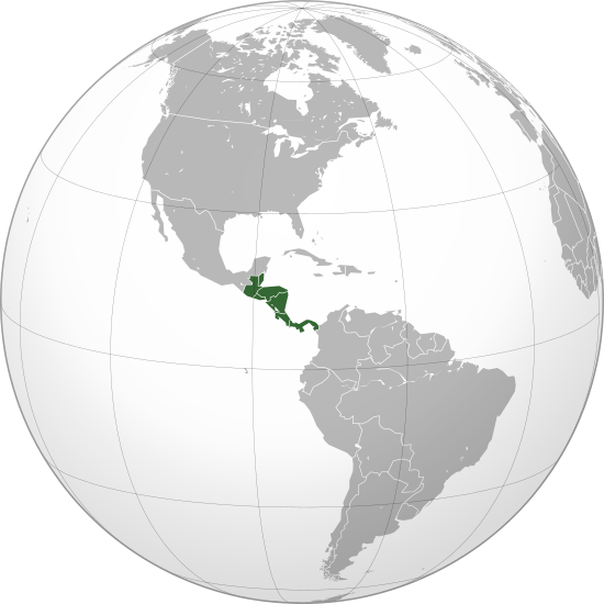
Archivo: Central America (orthographic projection)

Description: Central America (orthographic projection)
Title: Central America (orthographic projection)
Credit: Own work, This vector image was created with Inkscape. The map has been created with the Generic Mapping Tools: http://gmt.soest.hawaii.edu/ using one or more of these public-domain datasets for the relief: ETOPO2 (topography/bathymetry): http://www.ngdc.noaa.gov/mgg/global/global.html GLOBE (topography): http://www.ngdc.noaa.gov/mgg/topo/gltiles.html SRTM (topography): http://www2.jpl.nasa.gov/srtm/ বাংলা | English | Français | Italiano | 日本語 | Македонски | +/− Permission is granted to copy, distribute and/or modify this document under the terms of the GNU Free Documentation License, Version 1.2 or any later version published by the Free Software Foundation; with no Invariant Sections, no Front-Cover Texts, and no Back-Cover Texts. A copy of the license is included in the section entitled GNU Free Documentation License.http://www.gnu.org/copyleft/fdl.htmlGFDLGNU Free Documentation Licensetruetrue
Author: Heraldry
Permission: This image (or parts of it) was created by this user based on Adobe's Photoshop or Inkscape and probably converted to the portable network graphics format. It is (or includes) one of its different original designs, colours or styles from which you can choose.You are free to share and make derivative works of the file under the conditions that you appropriately attribute it.
Usage Terms: Creative Commons Attribution-Share Alike 3.0
License: CC-BY-SA-3.0
License Link: http://creativecommons.org/licenses/by-sa/3.0/
Attribution Required?: Yes
Usos del archivo
Las siguientes páginas enlazan a este archivo:
.svg&oldid=555342)

.svg)