
Archivo: Cascadia map and bioregion

Tamaño de esta previsualización: 381 × 600 píxeles. Otras resoluciones: 152 × 240 píxeles | 1588 × 2500 píxeles.
Archivo original (1588 × 2500 píxeles; tamaño de archivo: 115 KB; tipo MIME: image/png)
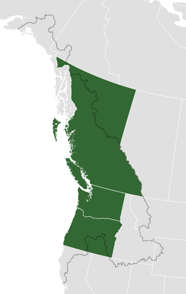
Descripción: A map showing the two definitions of the proposed "Republic of Cascadia." Green shows the American states of Oregon and Washington; and the Canadian province of British Columbia (which make up the standard definition). The black-dotted line marks the border of the Cascadia bioregion (which is also mentioned as a border).
Título: Cascadia map and bioregion
Créditos: Trabajo propio
Autor(a): NuclearVacuum
Términos de Uso: Creative Commons Attribution-Share Alike 3.0
Licencia: CC BY-SA 3.0
Enlace de Licencia: https://creativecommons.org/licenses/by-sa/3.0
¿Se exige la atribución?: Sí
Usos del archivo
La siguiente página enlaza a este archivo:

Todo el contenido de los artículos de la Enciclopedia Kiddle (incluidas las imágenes) se puede utilizar libremente para fines personales y educativos bajo la licencia Atribución-CompartirIgual a menos que se indique lo contrario.