
Archivo: Carrick Roads from near Tregear Vean - geograph.org.uk - 232416
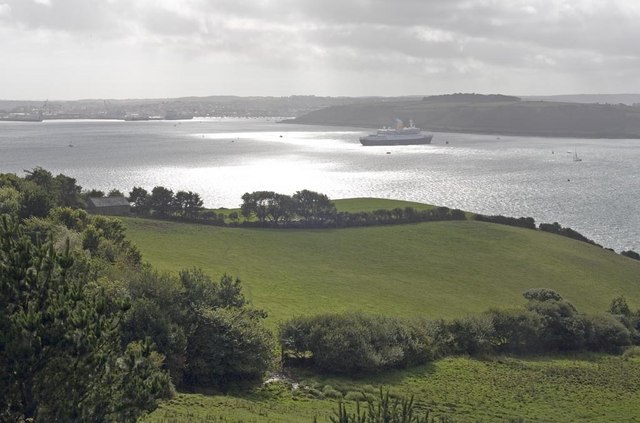
Descripción: Carrick Roads from near Tregear Vean. Foreground shows rolling pasture land typical of the area, and many low oak trees lining the Fal estuary. The port with docks seen in the distance is the town of Falmouth. The deep water inlet at this point is known as Carrick Roads, and is one of the largest natural harbours in the world, which can accommodate large cargo ships with ease. The cruise ship visible is "Saga Rose, but larger ships such as oil tankers are a frequent sight in these waters.
Título: Carrick Roads from near Tregear Vean - geograph.org.uk - 232416
Créditos: From geograph.org.uk
Autor(a): Philip White
Términos de Uso: Creative Commons Attribution-Share Alike 2.0
Licencia: CC BY-SA 2.0
Enlace de Licencia: https://creativecommons.org/licenses/by-sa/2.0
¿Se exige la atribución?: Sí
Usos del archivo
La siguiente página enlaza a este archivo:
