
Archivo: Canada election 2006
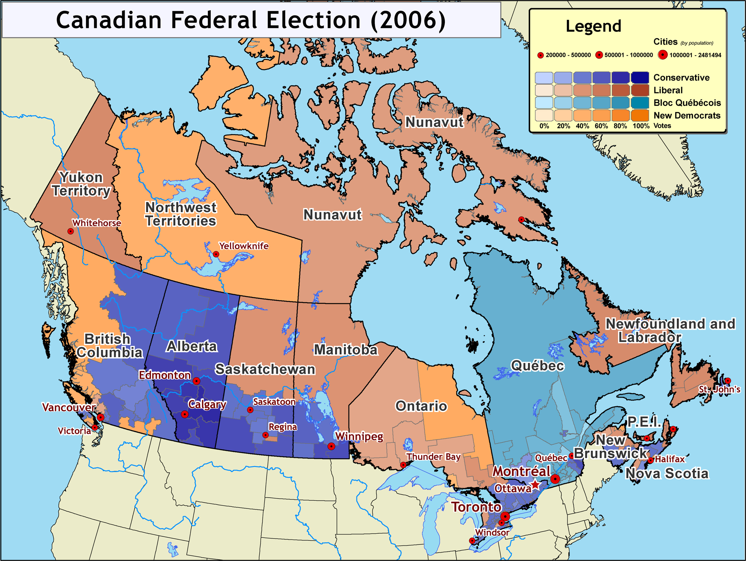
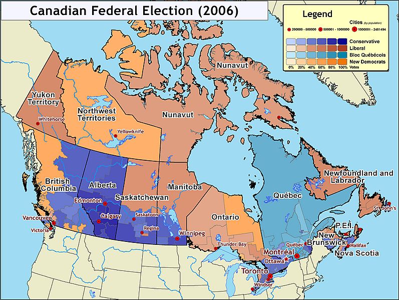
Descripción: Map of the 2006 Canadian federal election results (January 23, 2006) The Conservative party won a minority government, with Stephen Harper (of Calgary, Alberta) becoming Prime Minister. Alberta is the main stronghold for the Conservative party, with major support also coming from the interior regions of British Columbia, southern Saskatchewan, and Manitoba, as well as southern Ontario. Map created by Kmf164 (January 24, 2006). Map compiled using ArcGIS, Adobe Illustrator, and Adobe Photoshop, and is derived from data sources including: Geogratis - Natural Resources Canada / Elections Canada - Electoral district boundaries. The source data is copyright by the Government of Canada, however is free to use for any purpose, as long as acknowledgement is provided. Elections Canada - Elections results data.
Título: Canada election 2006
Créditos: Self-published work by Aude
Autor(a): Aude
Términos de Uso: Creative Commons Attribution-Share Alike 2.5
Licencia: CC BY-SA 2.5
Enlace de Licencia: https://creativecommons.org/licenses/by-sa/2.5
¿Se exige la atribución?: Sí
Usos del archivo
La siguiente página enlaza a este archivo:
