
Archivo: CYA Coastal Navigation With Dead Reckoning 2
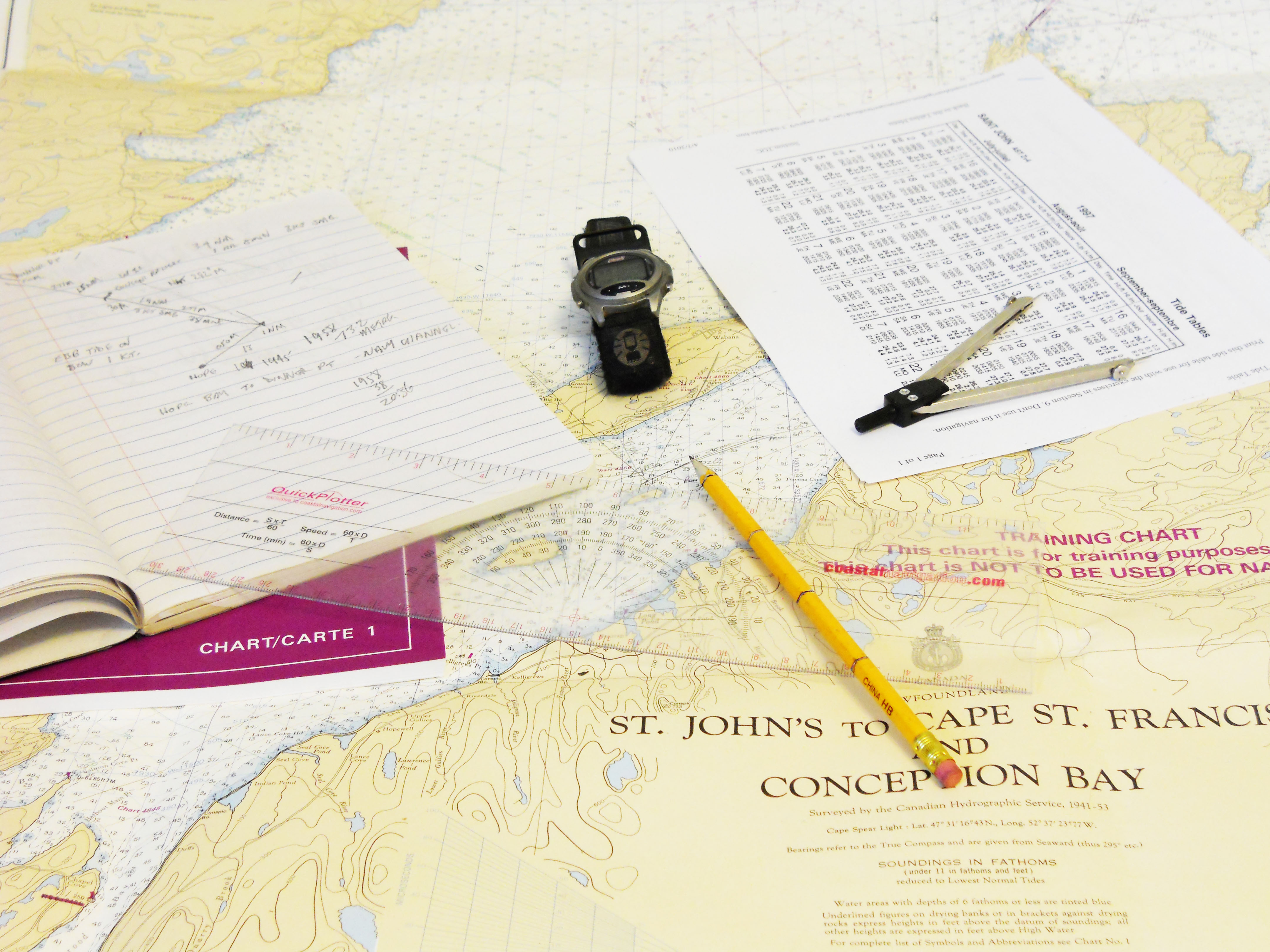
Descripción: Basic Marine Navigation tools for Dead Reckoning from the Canadian Yachting Association Coastal Navigation course. The objects are photographed on top of a nautical training chart. The purple book is "Chart 1"; on top of Chart 1 is a navigator's notebook with a Dead Reckoning navigation plan at the top of the page. A dead reckoning navigator must be able to tell time, so he has a rugged watch. He needs a Tide Table in tidal waters so he can determine the effects of tidal currents on the vessel's progress. Dividers are used to meaure distance. A plotter is used to draw course lines, bearings, and fixes on the chart. The navigator's pencil is marked off in 10 nautical mile intervals, to make estimating and double-checking easy. The tip of the pencil points to an area on the chart with several DR course lines, bearings, and fixes plotted.
Título: CYA Coastal Navigation With Dead Reckoning 2
Créditos: Trabajo propio
Autor(a): J. S. Bond
Términos de Uso: Creative Commons Attribution-Share Alike 3.0
Licencia: CC BY-SA 3.0
Enlace de Licencia: https://creativecommons.org/licenses/by-sa/3.0
¿Se exige la atribución?: Sí
Usos del archivo
La siguiente página enlaza a este archivo:
