
Archivo: Byzantine Constantinople-en
Tamaño de esta previsualización: 664 × 599 píxeles. Otras resoluciones: 266 × 240 píxeles | 3200 × 2888 píxeles.
Archivo original (3200 × 2888 píxeles; tamaño de archivo: 2,35 MB; tipo MIME: image/png)
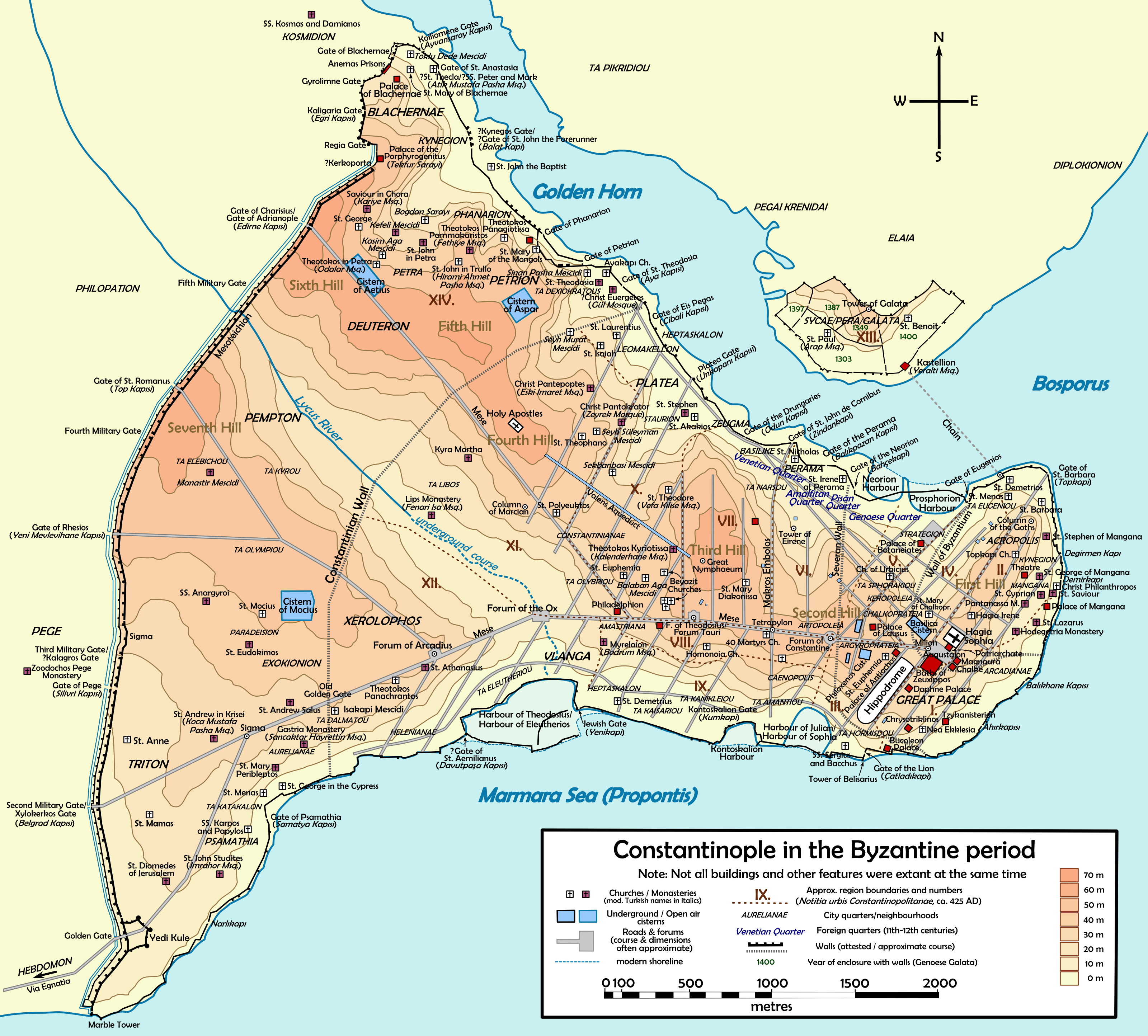
Description: Topographical map of Constantinople during the Byzantine period. Main map source: R. Janin, Constantinople Byzantine. Developpement urbain et repertoire topographique. Road network and some other details based on Dumbarton Oaks Papers 54; data on many churches, especially unidentified ones, taken from the New York University's The Byzantine Churches of Istanbul project. Other published maps and accounts of the city have been used for corroboration.
Author: Cplakidas
Usage Terms: Creative Commons Attribution-Share Alike 3.0
License: CC-BY-SA-3.0
License Link: http://creativecommons.org/licenses/by-sa/3.0/
Attribution Required?: Yes
Usos del archivo
La siguiente página enlaza a este archivo:

Todo el contenido de los artículos de la Enciclopedia Kiddle (incluidas las imágenes) se puede utilizar libremente para fines personales y educativos bajo la licencia Atribución-CompartirIgual a menos que se indique lo contrario.