
Archivo: Broadgate and Precincts - geograph.org.uk - 554599
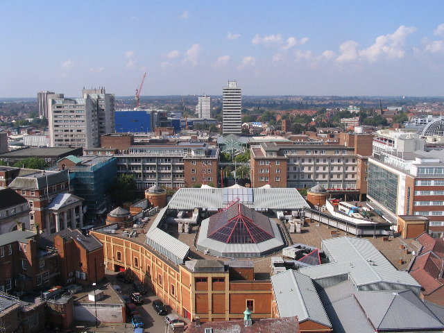
Description: Broadgate and Precincts Taken from the tower of the old cathedral church of St. Michael, looking westwards down the line of the Upper and Lower Precinct shopping areas towards Mercia House[1], the tower block at the bottom end of the Lower Precinct. To the right of Mercia House is the red sandstone tower of St John's Church. To its left a little further into the distance is the Skydome and Odeon complex in Spon Street, partially obscured by the blue blob of Ikea. The grey tower block to the left is Coventry Point in Market Way. In the foreground is the roof of the Cathedral Lanes shopping centre swamping Broadgate. Left foreground is Pepper Lane, running towards High Street. To see how it looked in 1975, see http://www.geograph.org.uk/photo/156892 and 1983 : http://www.geograph.org.uk/photo/1059854 .
Title: Broadgate and Precincts - geograph.org.uk - 554599
Credit: From geograph.org.uk
Author: E Gammie
Usage Terms: Creative Commons Attribution-Share Alike 2.0
License: CC BY-SA 2.0
License Link: http://creativecommons.org/licenses/by-sa/2.0
Attribution Required?: Yes
Usos del archivo
La siguiente página enlaza a este archivo:
