
Archivo: Bradford Texas 1835 UTA
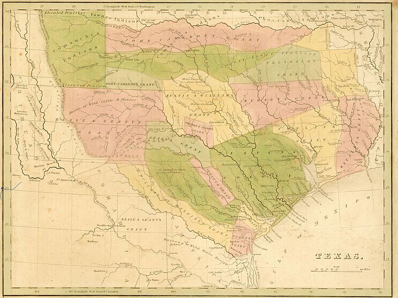
Descripción: This is believed to be the first map of Texas as an independent republic to appear in an atlas. It was produced by Thomas Gamaliel Bradford (1802-1887), a Boston editor and publisher. Bradford's Comprehensive Atlas from 1835 first appeared without the map but later variants, all dated 1835, include the map. It shows Texas divided up according to several of the original Mexican land grants, and it includes topographical features such as rivers, prairies, hills, towns, and settlements. Locations described as having "Droves of Wild Cattle & Horses" and "Mustang & Wild Horse Desert" clearly indicate the overwhelming influence of Stephen F. Austin and Henry S. Tanner's maps of Texas published in Philadelphia.
Título: Texas
Créditos: UTA Libraries Cartographic Connections: map / texto
Autor(a): Thomas Gamaliel Bradford
Términos de Uso: Dominio Público
Licencia: Dominio Público
¿Se exige la atribución?: No
Usos del archivo
Las siguientes páginas enlazan a este archivo:
