
Archivo: Boundaries in the Arctic - map-fr

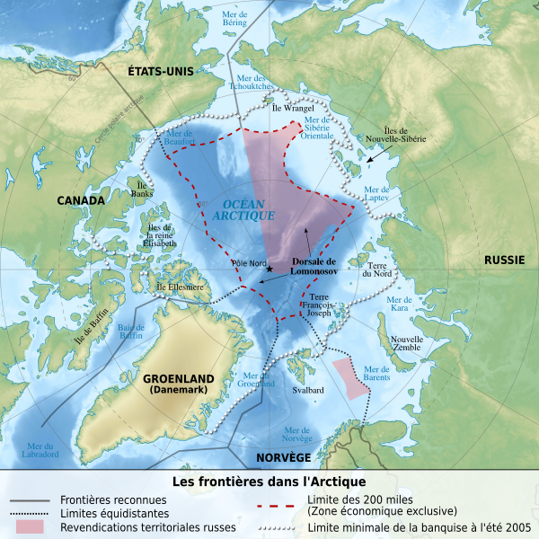
Descripción: Map of the Arctic, showing recognized boundaries, equidistant limits and Russian claims.
Título: Boundaries in the Arctic - map-fr
Créditos: Trabajo propio. Sources of data: Elevations and bathymetry : NGDC ETOPO1 (public domain) Shores : NASA SWBD (public domain) Terrestrial boundaries : NGDC World Data Bank II (public domain) Sea boundaries, equidistant limits and russian claims : File:Arctic-claims.png by Ahnode (public domain)
Autor(a): Sémhur (talk) 17:52, 13 December 2009 (UTC)
Permiso: Attribution and Share-Alike required: any use of this picture can be made as long as you credit me (Wikimedia Commons user: Sémhur) as the creator and distribute the copies and derivative works under the same license that the one indicated below.
Términos de Uso: Creative Commons Attribution-Share Alike 4.0
Licencia: CC BY-SA 4.0
Enlace de Licencia: https://creativecommons.org/licenses/by-sa/4.0
¿Se exige la atribución?: Sí
Usos del archivo
La siguiente página enlaza a este archivo:
