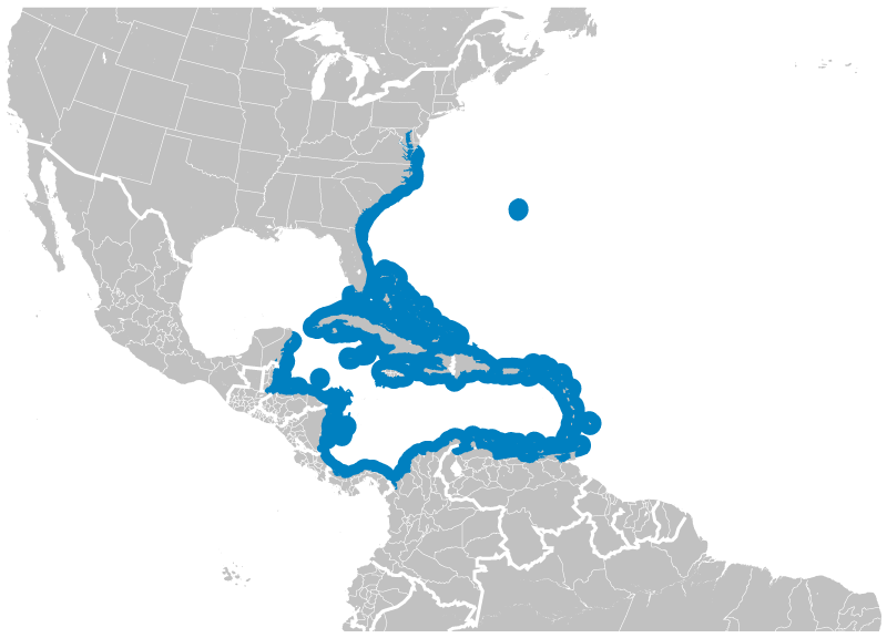
Archivo: Blue Parrotfish Scarus coeruleus distribution map
Description: Geographical distribution of the Blue Parrotfish Scarus coeruleus. The map was created using the Generic Mapping Tools, GMT, version 5.1.2.
Title: Blue Parrotfish Scarus coeruleus distribution map
Credit: Own work using: the IUCN Red List spatial data to draw the borders of the Scarus coeruleus range: http://maps.iucnredlist.org/map.html?id=190709 Credit for the spatial data: International Union for Conservation of Nature (IUCN) 2012. Scarus coeruleus. In: IUCN 2015. The IUCN Red List of Threatened Species. Version 2015.2. http://www.iucnredlist.org. Downloaded on 24 July 2015. Species account: http://www.iucnredlist.org/details/190709/0 Rocha, L.A., Choat, J.H., Clements, K.D., Russell, B., Myers, R., Lazuardi, M.E., Muljadi, A., Pardede, S. & Rahardjo, P. 2012. Scarus coeruleus. The IUCN Red List of Threatened Species. Version 2015.2. <www.iucnredlist.org>. Downloaded on 24 July 2015. [[File:|32x20px]] This map was created with GMT.
Author: Darekk2 using the IUCN Red List spatial data
Usage Terms: Creative Commons Attribution-Share Alike 4.0
License: CC BY-SA 4.0
License Link: https://creativecommons.org/licenses/by-sa/4.0
Attribution Required?: Yes
Usos del archivo
La siguiente página enlaza a este archivo:


