
Archivo: BitterrootNFMap
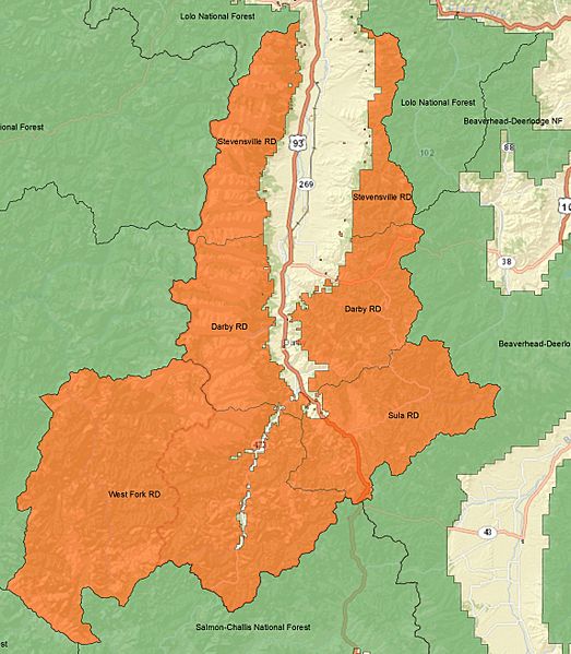
Descripción: A map of the Bitterroot National Forest in western Montana and eastern Idaho. The Darby, Stevensville, Sula, and West Fork River Ranger Districts of the Bitterroot National Forest are in orange. The Bitterroot Mountains are protected within the National forest. Surrounding National forests are in green, including the Beaverhead-Deerlodge National Forest, Lolo National Forest, Salmon-Challis National Forest, and Clearwater National Forest (label not completely visible).CreditsThis map was made using ARCMAP 10.1, and all data are in the public domain. Forest Service boundary data are from the US Forest Service FSGeodata Clearinghouse
Título: BitterrootNFMap
Créditos: Trabajo propio
Autor(a): Fredlyfish4
Términos de Uso: Creative Commons Attribution-Share Alike 3.0
Licencia: CC BY-SA 3.0
Enlace de Licencia: https://creativecommons.org/licenses/by-sa/3.0
¿Se exige la atribución?: Sí
Usos del archivo
No hay páginas que enlacen a esta imagen.
