
Archivo: Biafra independent state map-en

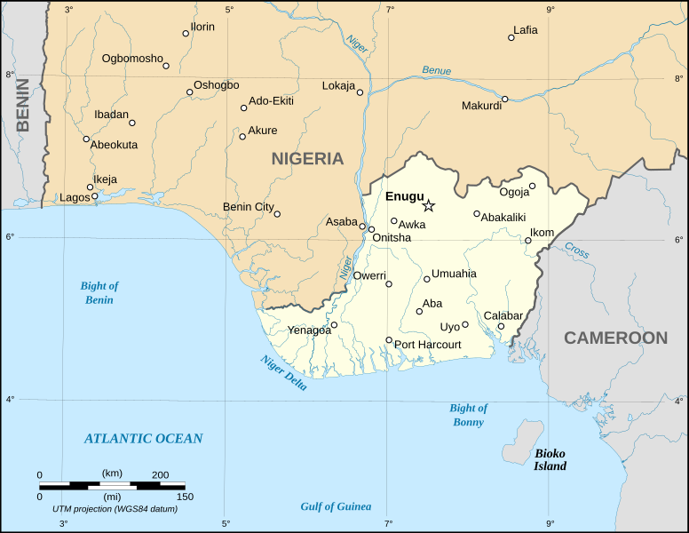
Descripción: Map of the secessionist state of the Republic of Biafra (1967 – 1970) as in May 1967. Note: The western boundary may not be accurate due to the low precision of the reference maps used which are also contradictory.
Título: Biafra independent state map-en
Créditos: Own work Background map: NGDC GSHHS and WDBII data Biafra independent state borders reference maps: UN, Matthew White, Otvaga2004, Travel-Image (originally a CIA map ?), Biafraland and MSN Encarta
Autor(a): Eric Gaba (Sting - fr:Sting)
Permiso: Attribution and Share-Alike required Any use of this map can be made as long as you credit me (Eric Gaba – Wikimedia Commons user: Sting) as the author and distribute the copies and derivative works under the same license(s) that the one(s) stated below. A message with a reply address would also be greatly appreciated.
Términos de Uso: Creative Commons Attribution-Share Alike 3.0
Licencia: CC BY-SA 3.0
Enlace de Licencia: http://creativecommons.org/licenses/by-sa/3.0/
¿Se exige la atribución?: Sí
Usos del archivo
La siguiente página enlaza a este archivo:
