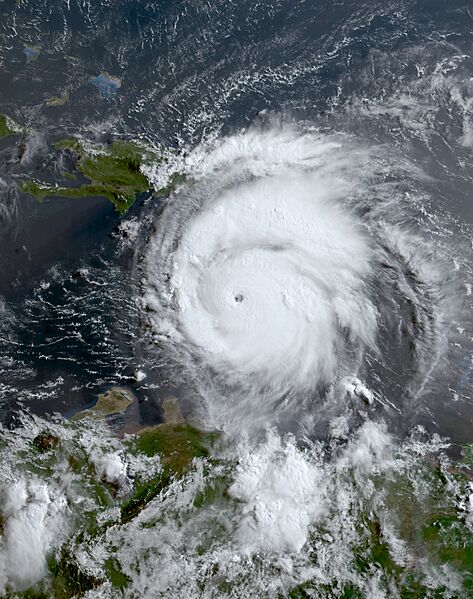
Archivo: Beryl 2024-07-02 1230Z

Descripción: This true-color representation of Hurricane Beryl moving over the Caribbean Sea was captured during the morning of July 2, 2024, at 12:30 UTC, employing the Advanced Baseline Imager (ABI) instrument aboard the geostationary orbiting GOES-16 satellite launched by NASA and NOAA in November 2016, the satellite and its instrumentation serve to monitor meteorological phenomena like Beryl. Hurricane Beryl, a extremely powerful, compact, deadly, and destructive cyclone, emerged from an tropical wave within the primary development zone of the Atlantic Ocean during the early part of the 2024 Atlantic hurricane season. At the time of imaging, the storm exhibited peak intensity strength, boasting maximum sustained winds of 165 mph (266 km/h) (145 knots) on the 1-minute Saffir-Simpson scale, classifying it as an powerful Category 5 major hurricane, the earliest on record beating out Hurricane Emily of 2005 by two weeks. Its minimum central pressure hovered at 935 mbar (27.6 inHg). Additionally, Beryl broke several other records, including being the earliest Category 4 hurricane, surpassing Hurricane Dennis of 2005. It also became the strongest June hurricane by wind speed on record, achieving Category 4 status on June 30.
Términos de Uso: Dominio Público
Usos del archivo
La siguiente página enlaza a este archivo:

