
Archivo: Beryl 2012-05-27 1835Z
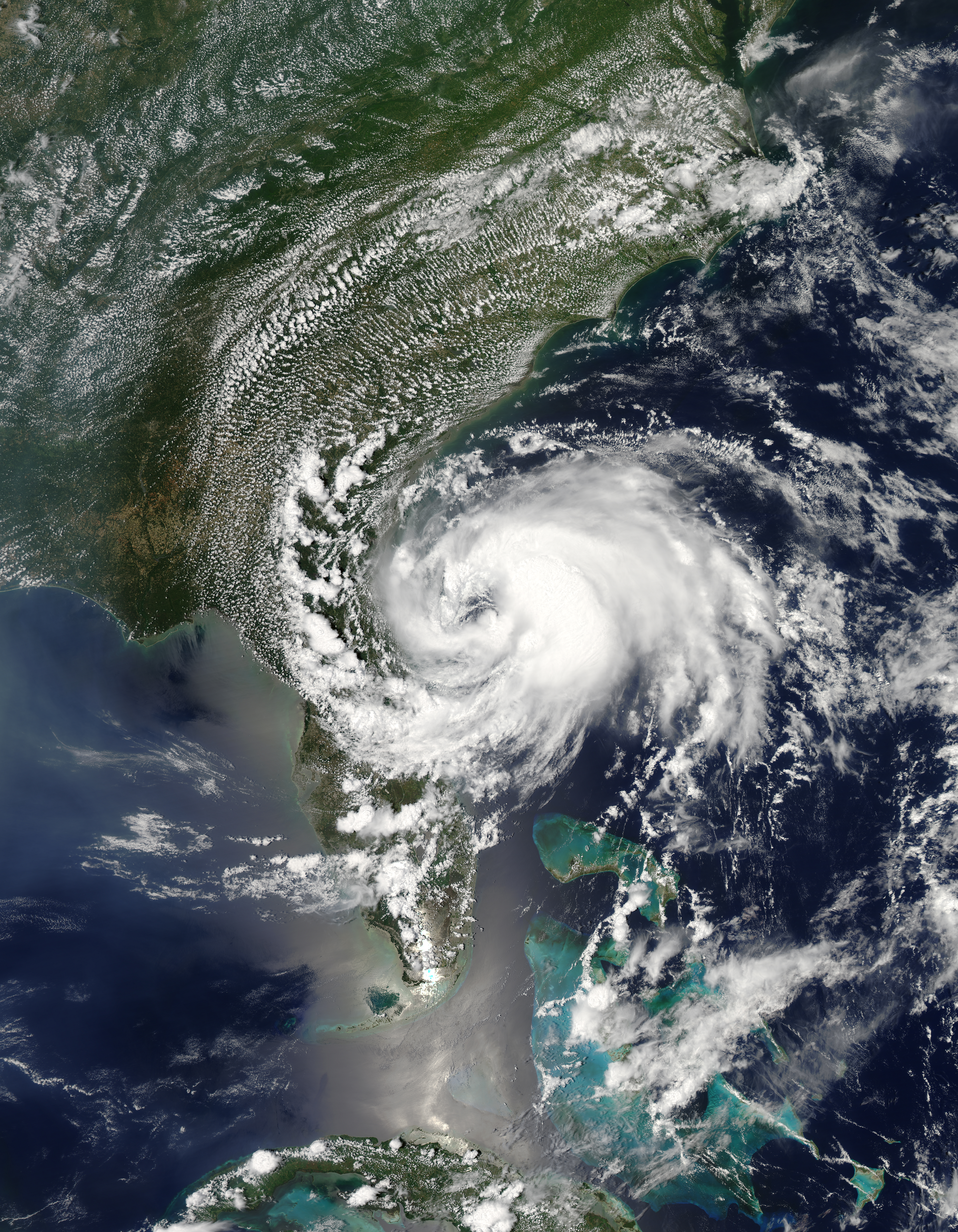
Descripción: Beryl first formed as a subtropical storm over the Atlantic Ocean on May 25, 2012. The U.S. National Hurricane Center (NHC) tracked the storm’s progress, and at 2:00 p.m. Eastern Daylight Time (EDT) on May 27, the NHC announced that the storm was located roughly 110 miles (175 kilometers) east of Jacksonville, Florida. Having strengthened into a tropical storm, Beryl had maximum sustained winds of 65 miles (100 kilometers) per hour. The Moderate Resolution Imaging Spectroradiometer (MODIS) on NASA’s Aqua satellite captured this natural-color image of Beryl on May 27, around 2:30 p.m. EDT. Beryl was making landfall along Florida’s east coast. The NHC warned that the hazards affecting land included high winds and flooding resulting from a combination of the storm surge and the tide.
Título: Beryl 2012-05-27 1835Z
Créditos: http://earthobservatory.nasa.gov/NaturalHazards/view.php?id=78120
Autor(a): NASA image courtesy Jeff Schmaltz, LANCE MODIS Rapid Response Team, Goddard Space Flight Center. Caption by Michon Scott
Términos de Uso: Dominio Público
Licencia: Dominio Público
¿Se exige la atribución?: No
Usos del archivo
El siguiente archivo es un duplicado de éste (más detalles):
No hay páginas que enlacen a esta imagen.
