
Archivo: Baginbun Head Map

Tamaño de esta previsualización: 800 × 509 píxeles. Otras resoluciones: 320 × 204 píxeles | 825 × 525 píxeles.
Archivo original (825 × 525 píxeles; tamaño de archivo: 17 KB; tipo MIME: image/png)
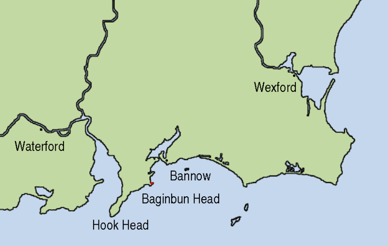
Descripción: Map showing the location of Baginbun Head where Raymond le Gros landed in 1170 in Ireland. Waterford and Wexford were Norse settlements at that time. The first landing of the Normans took place at Bannow Island in 1169. (This island meanwhile joined the mainland.)
Título: Baginbun Head Map
Créditos: This map is based on Image:Topography Ireland.jpg and my own work using Gimp and xfig.
Autor(a): AFBorchert
Términos de Uso: Creative Commons Attribution-Share Alike 4.0
Licencia: CC BY-SA 4.0
Enlace de Licencia: https://creativecommons.org/licenses/by-sa/4.0
¿Se exige la atribución?: Sí
Usos del archivo
La siguiente página enlaza a este archivo:

Todo el contenido de los artículos de la Enciclopedia Kiddle (incluidas las imágenes) se puede utilizar libremente para fines personales y educativos bajo la licencia Atribución-CompartirIgual a menos que se indique lo contrario.