
Archivo: BNSF Map
Tamaño de esta previsualización: 744 × 600 píxeles. Otras resoluciones: 298 × 240 píxeles | 1082 × 872 píxeles.
Archivo original (1082 × 872 píxeles; tamaño de archivo: 70 KB; tipo MIME: image/png)
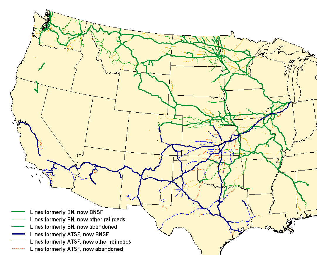
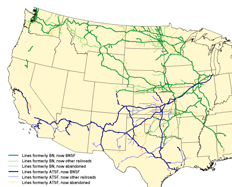
Description: Map of the merger of the en:Burlington Northern Railroad and the en:Atchison, Topeka and Santa Fe Railway to form the en:BNSF Railway. See the map legend for details. Created with Quantum GIS with data from the National Transportation Atlas Database.
Title: BNSF Map
Credit: Transferred from en.wikipedia to Commons by Quatro Valvole. This PNG graphic was created with QGIS.
Author: The original uploader was Elkman at English Wikipedia.
Usage Terms: Creative Commons Attribution-Share Alike 3.0 truetrue
License: CC-BY-SA-3.0
License Link: http://creativecommons.org/licenses/by-sa/3.0/
Attribution Required?: Yes
Usos del archivo
La siguiente página enlaza a este archivo:

Todo el contenido de los artículos de la Enciclopedia Kiddle (incluidas las imágenes) se puede utilizar libremente para fines personales y educativos bajo la licencia Atribución-CompartirIgual a menos que se indique lo contrario.