
Archivo: Ashoka Maurya Empire
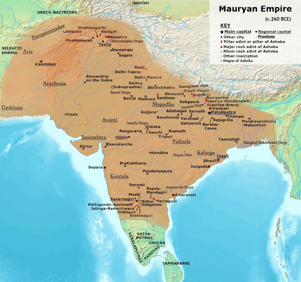
Descripción: Maximum extent of the Maurya Empire, as shown by the location of Ashoka's inscriptions, and visualized by A.S.I. based on ancient inscriptions, ancient Greecian , ancient Indian texts[1] modern archaeologist :Nayanjot Lahiri[2], Dougald J. W. O'Reilly[3] old archeologist :D.R. Bhandarkar[4], Myra Shackley:[5] modern historian : Robert W. Strayer[6], Eric Nelson[7], Upinder Singh[8], Jackson J. Spielvogel[9], Hugh Bowden[10], Ram Sharan Sharma[11], Charles Allen[12], Neil MacGregor[13], Grigory Bongard-Levin[14] old historian:Mark F. Whitters[15], Jiu-Hwa Lo Upshur[16], Janice J. Terry[17], Michael J. Schroeder[18], Marsha E. Ackermann[19], Radha Kumud Mukherjee[20][21], John Haywood[22], Patrick Karl O'Brien[23][24], H. C. Raychaudhuri[25], John F. Cady[26], Gerald Danzer[27], Vincent Arthur Smith[28], Robert Roswell Palmer[29], Geoffrey Parker[30] historical geographer:Joseph E. Schwartzberg[31] anthropologist and bioarcheologist : Ian Barnes[32]
Título: Ashoka Maurya Empire
Créditos: I used User:Avantiputra7s map Maurya Empire, c.250 BCE 2.png. User:Cattettes map File:The_Hellenistic_World_in_late_281_BC.png for Paropamisadai province location, later used Greecian texts Pliny and Strabo for northeastern boundaries after that I used en-wiki Stupas page[1] to mark Ashoka Stupas. Most of the stupas I marked by using British Historian Geoffrey Parker designed map on Mauryan Empire pg.29[2].
Autor(a): Levakpitam
Términos de Uso: Creative Commons Attribution-Share Alike 3.0
Licencia: CC BY-SA 3.0
Enlace de Licencia: https://creativecommons.org/licenses/by-sa/3.0
¿Se exige la atribución?: Sí
Usos del archivo
Las siguientes páginas enlazan a este archivo:
