
Archivo: Arrowsmith Mexico 1832 UTA
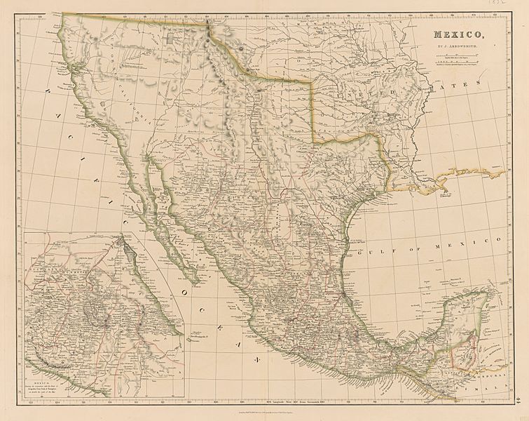
Descripción: John Arrowsmith's 1832 map of Mexico was a compilation of the latest and best sources available in London and has been called "…arguably the best map of the country published prior to the 1850s."[1] Not surprisingly, John used his uncle Aaron Arrowsmith's 1810 Map of Mexico (which had relied heavily upon Alexander von Humboldt's map of New Spain published in his Atlas Geographique et Physique de la Nouvelle Espagne in 1809 as well as Royal Navy coastal charts) as the base map. However, John's map included a number of the country's important roads for the first time on a printed map, employing double lines to refer to primary roads, single lines for secondary roads, and dotted lines for paths. Much of the information for the roads and trails came from British travelers in Mexico such as diplomat Henry George Ward (1797-1860) and Royal Navy officers R. W. H. Hardy (ca. 1790-1871) and Frederick William Beechey (1796-1856). References ↑ Allen, David Y. (April 2018). "Emerging from Humboldt's Shadow: British Travelers and John Arrowsmith's Maps of Mexico, 1822-1844". Terrae Incognitae 50 (1).
Título: Mexico
Créditos: UTA Libraries Cartographic Connections: map / texto
Autor(a): John Arrowsmith (cartographer)
Términos de Uso: Dominio Público
Licencia: Dominio Público
¿Se exige la atribución?: No
Usos del archivo
La siguiente página enlaza a este archivo:
